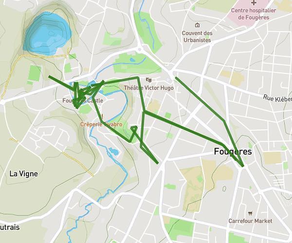
This hiking trail covers 6.485mi starting from Fougères, Ille-et-Vilaine. The hike does not return to the trailhead and ends near 6 Rue De L'hospice, 35300 Fougères, France. This hike is rated as moderate, plan for about 4h27m to complete it. The route has an elevation gain of 797ft and an elevation loss of 705ft.
fougeres
Route details
1.45mph
Speed
1945 kcal
Calories burned
4.4%
Avg grade
Point to point
Route type
292ft
Min altitude
456ft
Max altitude
Route profile
797ft
Elevation gain
705ft
Elevation loss
292ft
Min altitude
456ft
Max altitude
How to get there
Trailhead: 10 Place De La République, 35300 Fougères, France
GPS coordinates of the trailhead: 48.34984, -1.19559 / 48°20'59'' N, 1°11'44'' W