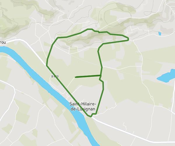
This running route covers 5.613mi starting from Ambrus, Lot-et-Garonne. The run is a loop trail and returns to the trailhead. This run is rated as moderate, expect about 54m to complete it. The route has an elevation gain of 85ft and an elevation loss of 115ft.
Ambrus
Route details
6.24mph
Speed
617 kcal
Calories burned
Loop trail
Route type
440ft
Min altitude
554ft
Max altitude
Route profile
85ft
Elevation gain
115ft
Elevation loss
440ft
Min altitude
554ft
Max altitude
How to get there
Trailhead: 1090 Route De Bataille, 47160 Ambrus, France
GPS coordinates of the trailhead: 44.22462, 0.23407 / 44°13'28'' N, 0°14'2'' E