MapPlanner
7.389mi
Distance
45m
Duration
9.85mph
Speed
+157ft
Elevation gain
-180ft
Elevation loss
Easy
Level

aaa

Route details

396 kcal
Calories burned
0.9%
Avg grade
Loop trail
Route type
906ft
Min altitude
997ft
Max altitude

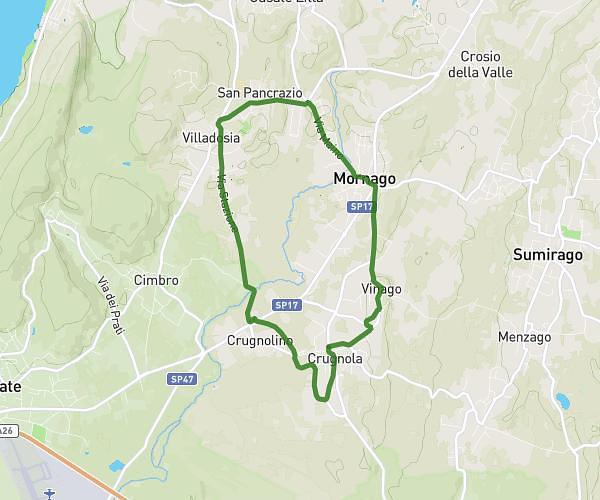
This cycling route covers 7.389mi starting from Mornago, Varese. The ride is a loop trail and returns to the trailhead. This route is rated as easy, plan for about 45m to complete it. The route has an elevation gain of 157ft and an elevation loss of 180ft.

Route profile

157ft
Elevation gain
180ft
Elevation loss
906ft
Min altitude
997ft
Max altitude

How to get there

Trailhead: Via Giuseppe Verdi 4, 21020 Mornago Varese, Italy

GPS coordinates of the trailhead: 45.729182, 8.746725 / 45°43'45'' N, 8°44'48'' E

Caution: May Cross Private Property

This route may pass through or near private property. Always respect posted signs, obtain permission where required, and follow local trespassing laws. MapPlanner does not guarantee public access along any route.

Safety Notice

Trail and road conditions may change without notice due to weather, construction, or other factors. Always verify current conditions before heading out. You are responsible for your own safety — follow local signage, obey traffic laws, and use your best judgment on the trail.