MapPlanner
5.42mi
Distance
45m
Duration
7.23mph
Speed
+46ft
Elevation gain
-52ft
Elevation loss
Easy
Level

Vanzago - Mantegazza - Pregnana - Vanzago

Route details

395 kcal
Calories burned
0.3%
Avg grade
Loop trail
Route type
492ft
Min altitude
545ft
Max altitude

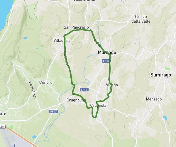
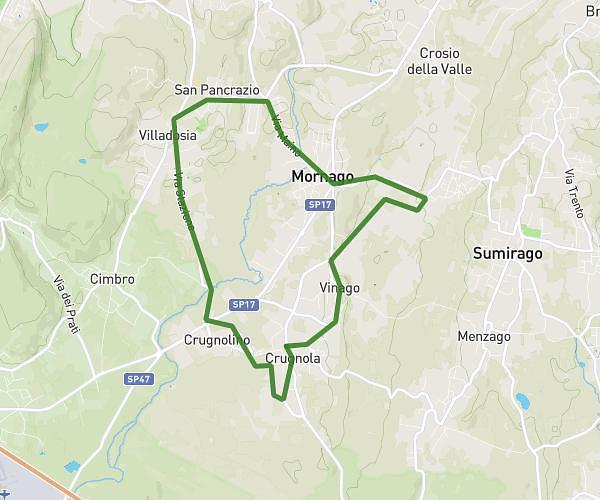
This cycling route covers 5.42mi starting from Vanzago, Milan. The ride is a loop trail and returns to the trailhead. This route is rated as easy, plan for about 45m to complete it. The route has an elevation gain of 46ft and an elevation loss of 52ft.

Description of the route by the creator

apart from the intersection where you come out on the provincial road, not bad from the

(Description automatically translated)

Route profile

46ft
Elevation gain
52ft
Elevation loss
492ft
Min altitude
545ft
Max altitude

How to get there

Trailhead: Via Magistrelli, 20043 Vanzago

GPS coordinates of the trailhead: 45.52859, 8.9965 / 45°31'42'' N, 8°59'47'' E

Caution: May Cross Private Property

This route may pass through or near private property. Always respect posted signs, obtain permission where required, and follow local trespassing laws. MapPlanner does not guarantee public access along any route.

Safety Notice

Trail and road conditions may change without notice due to weather, construction, or other factors. Always verify current conditions before heading out. You are responsible for your own safety — follow local signage, obey traffic laws, and use your best judgment on the trail.