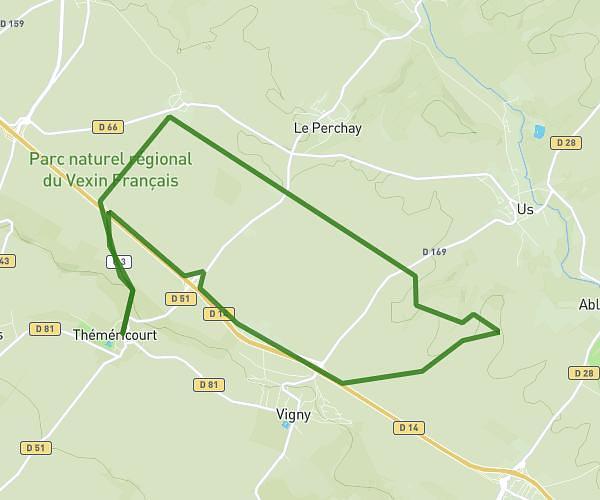
This running route covers 9.946mi starting from Chaumontel, Val-d'Oise. The run is a loop trail and returns to the trailhead. This run is rated as hard, expect about 1h36m to complete it. The route has an elevation gain of 1083ft and an elevation loss of 1083ft.
Balade avec Greg
Route details
6.21mph
Speed
1098 kcal
Calories burned
Loop trail
Route type
144ft
Min altitude
410ft
Max altitude
Route profile
1083ft
Elevation gain
1083ft
Elevation loss
144ft
Min altitude
410ft
Max altitude
How to get there
Trailhead: 31 Rue Des Coteaux, 95270 Chaumontel, France
GPS coordinates of the trailhead: 49.121759, 2.438968 / 49°7'18'' N, 2°26'20'' E