MapPlanner
5.766mi
Distance
3h30m
Duration
+1401ft
Elevation gain
-1398ft
Elevation loss
Hard
Level

Calanques de Morgiou puis Sugiton au départ de Luminy

View of the cove and the port of Morgiou
The port of Morgiou
The port of Morgiou
The entrance to the wild cove of Sugiton
Calanque of Sugiton
Calanque of Sugiton
The cove of Sugiton seen from the top

Route details

1.65mph
Speed
1583 kcal
Calories burned
9.2%
Avg grade
Loop trail
Route type
13ft
Min altitude
715ft
Max altitude
Steep climb

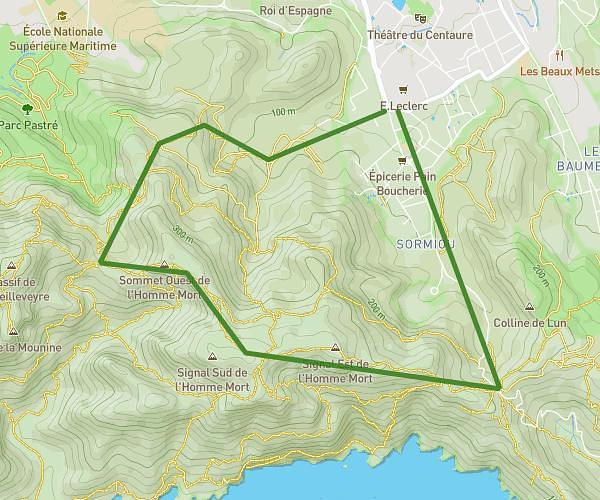
This hiking trail covers 5.766mi starting from Marseille, Bouches-du-Rhône. The hike is a loop trail and returns to the trailhead. This hike is rated as hard, plan for about 3h30m to complete it. The route has an elevation gain of 1401ft and an elevation loss of 1398ft.

Description of the route by the creator

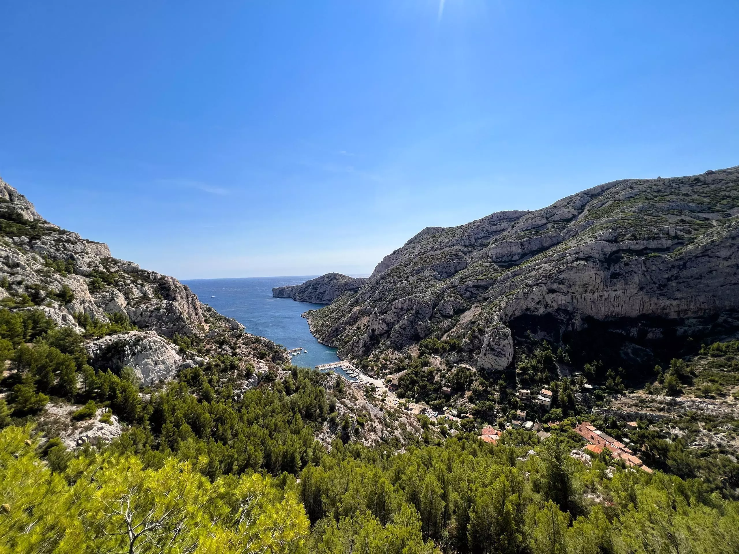
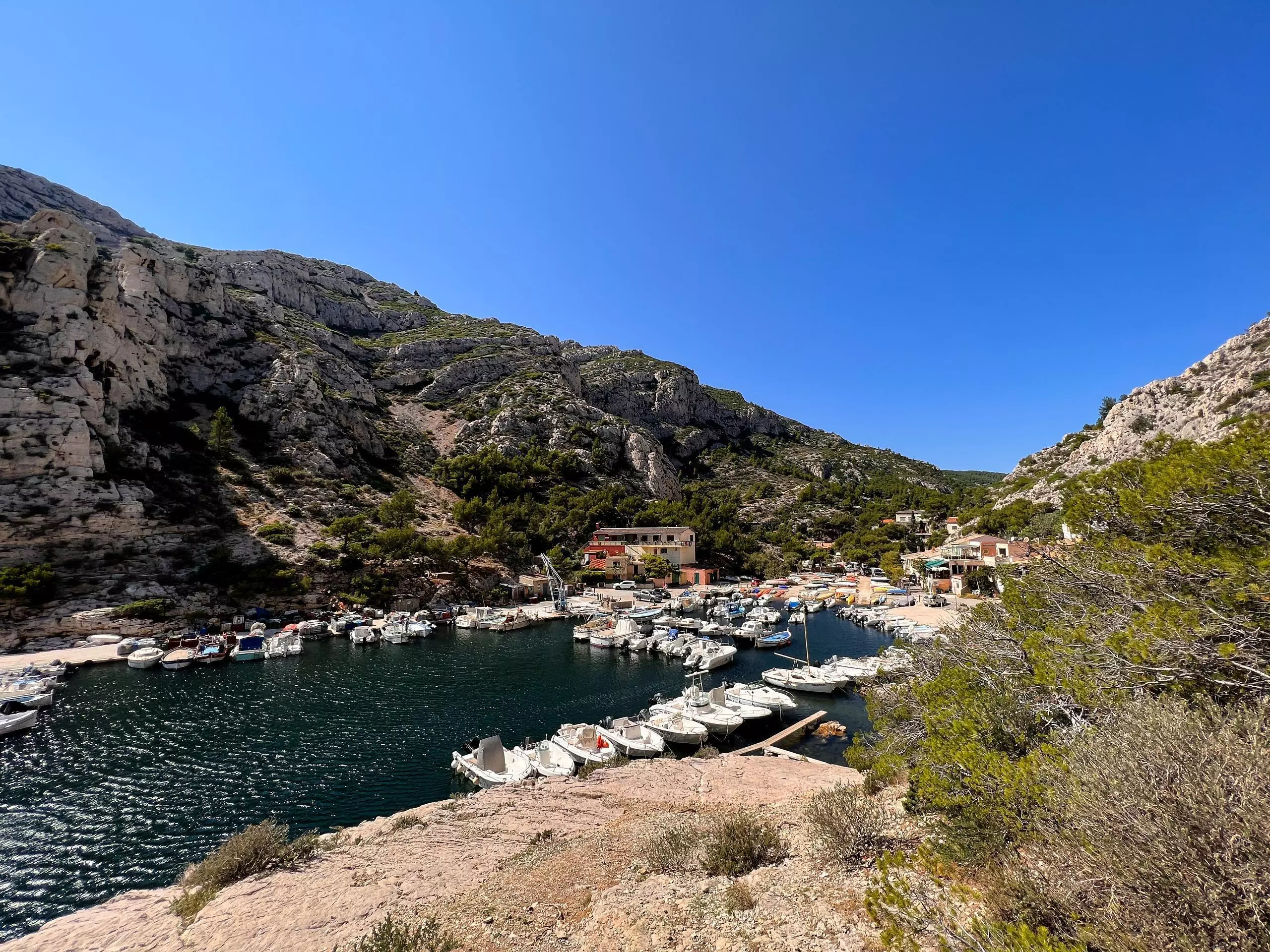
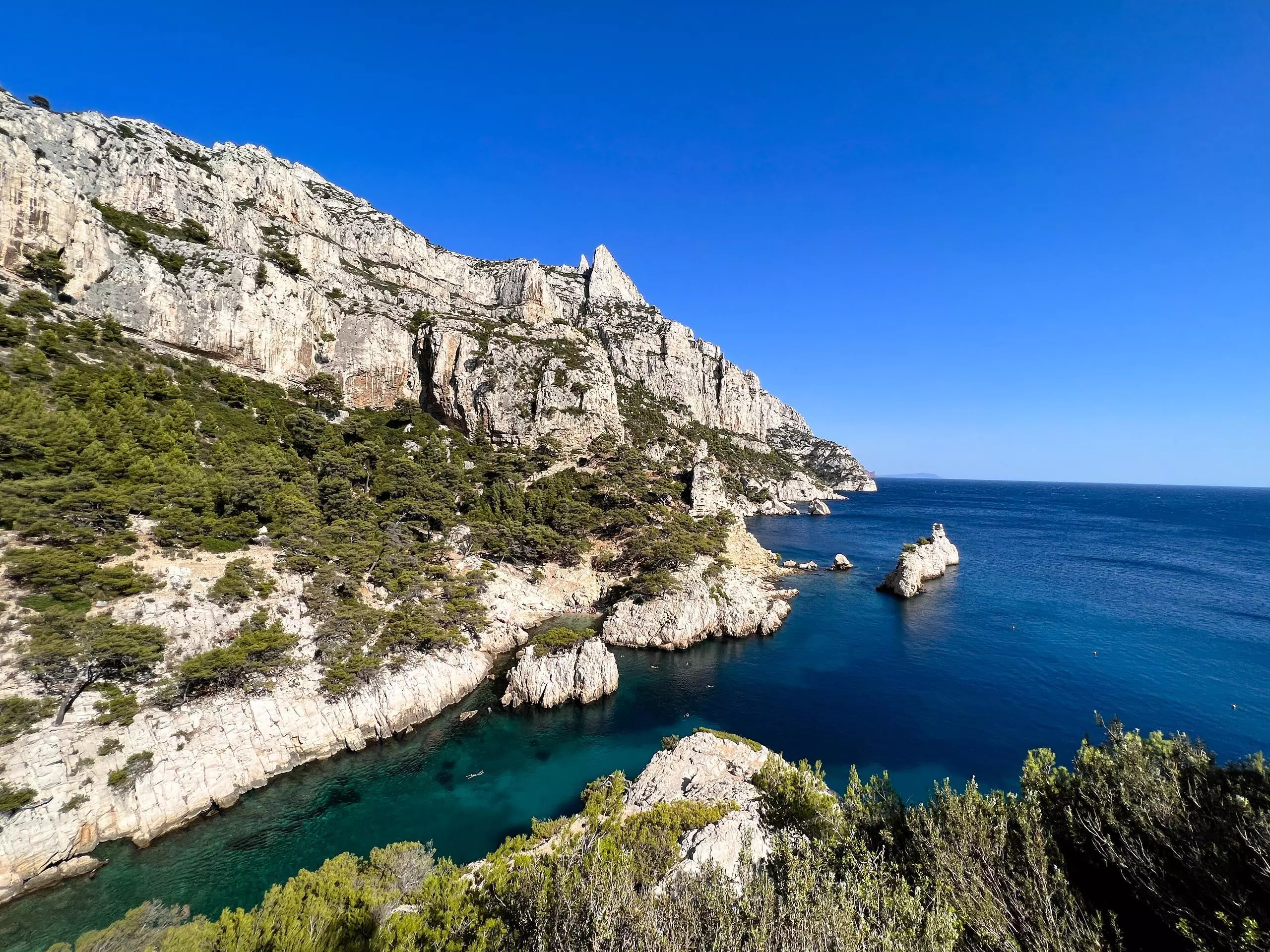
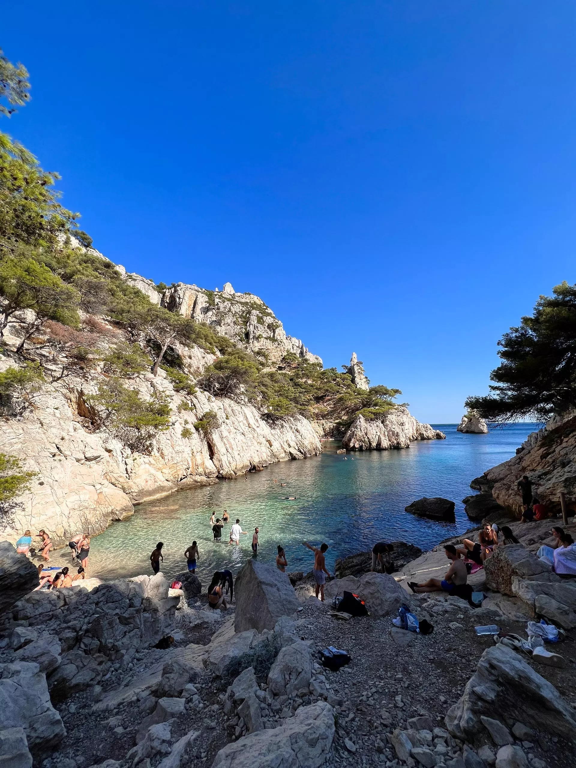
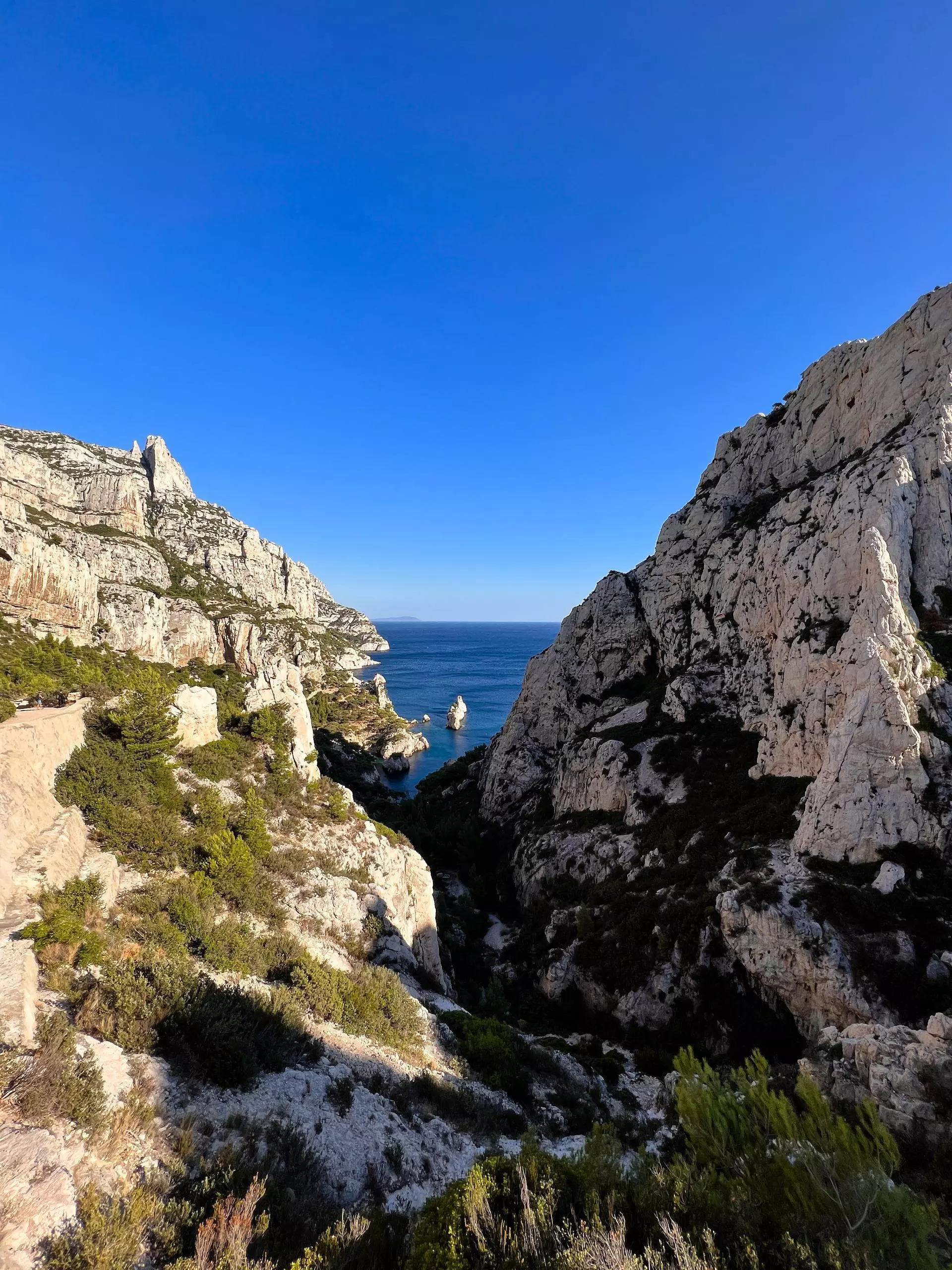
Park in the University parking lot (follow the signs to the parking lot). Leave the university campus and follow the colored marks to reach the Calanque de Morgiou. Then go around the cliff, still following the colored marks, until you reach the Calanque de Sugiton (ideal for swimming). The path is steep, be careful along the cliff. Finally return by the main path

(Description automatically translated)

Route profile

1401ft
Elevation gain
1398ft
Elevation loss
13ft
Min altitude
715ft
Max altitude

How to get there

Trailhead: Rond-Point Suzanne Taxy, 13009 Marseille, France

GPS coordinates of the trailhead: 43.23157, 5.4321 / 43°13'53'' N, 5°25'55'' E

Caution: May Cross Private Property

This route may pass through or near private property. Always respect posted signs, obtain permission where required, and follow local trespassing laws. MapPlanner does not guarantee public access along any route.

Safety Notice

Trail and road conditions may change without notice due to weather, construction, or other factors. Always verify current conditions before heading out. You are responsible for your own safety — follow local signage, obey traffic laws, and use your best judgment on the trail.