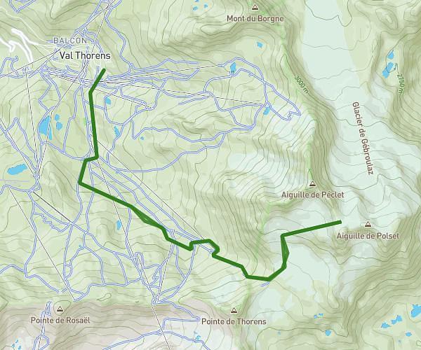
Explore this hiking route of 8,188mi starting from Les Belleville, Savoie. The hike is a loop and returns to the starting point. This hike has no defined difficulty level, plan for about 3h2m to complete it. The route has a positive elevation gain of 2625ft and a negative elevation loss of 2635ft.
Roc de fer
Route details
Route profile
2625ft
Elevation +
2635ft
Elevation -
4905ft
Min altitude
7480ft
Max altitude
How to get there
Route starting point: Route Des Ménuires, 73440 Les Belleville, France
GPS coordinates of the starting point: 45.371532, 6.510846 / 45°22'17'' N, 6°30'39'' E