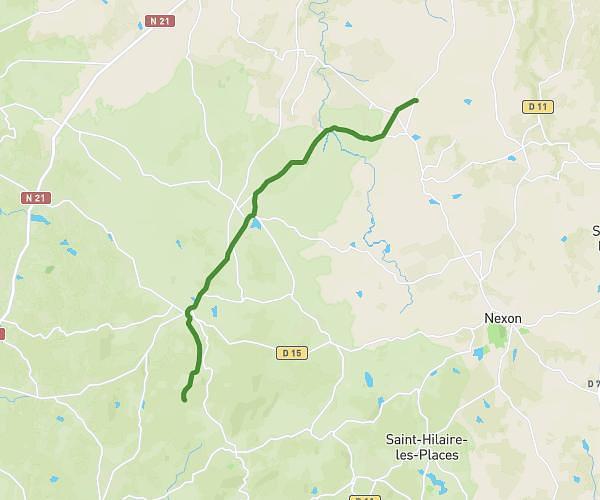
This running route covers 6.217mi starting from Saint-Bazile, Haute-Vienne. The run does not return to the trailhead and ends near D 10, 87600 Rochechouart, France. This run is rated as moderate, expect about 1h to complete it. The route has an elevation gain of 0ft and an elevation loss of 407ft.
10km Vayres - Rochechouart
Route details
6.22mph
Speed
686 kcal
Calories burned
Point to point
Route type
646ft
Min altitude
1056ft
Max altitude
Route profile
0ft
Elevation gain
407ft
Elevation loss
646ft
Min altitude
1056ft
Max altitude
How to get there
Trailhead: D 675, 87150 Saint-Bazile, France
GPS coordinates of the trailhead: 45.74302, 0.80502 / 45°44'34'' N, 0°48'18'' E