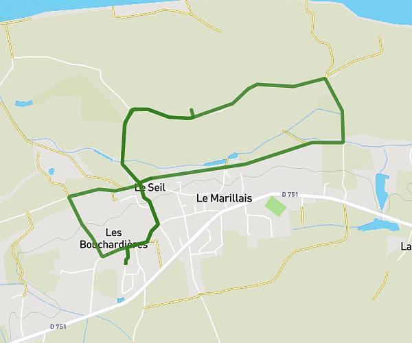
This running route covers 3.503mi starting from Loiré, Maine-et-Loire. The run is a loop trail and returns to the trailhead. This run is rated as easy, expect about 34m to complete it. The route has an elevation gain of 180ft and an elevation loss of 180ft.
Autour de la maison 10
Route details
6.18mph
Speed
389 kcal
Calories burned
Loop trail
Route type
115ft
Min altitude
240ft
Max altitude
Route profile
180ft
Elevation gain
180ft
Elevation loss
115ft
Min altitude
240ft
Max altitude
How to get there
Trailhead: L'ogerie, 49440 Loiré
GPS coordinates of the trailhead: 47.60823, -0.95126 / 47°36'29'' N, 0°57'4'' W