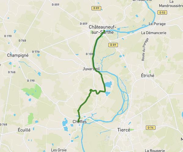
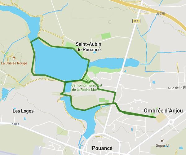
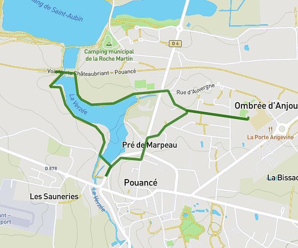
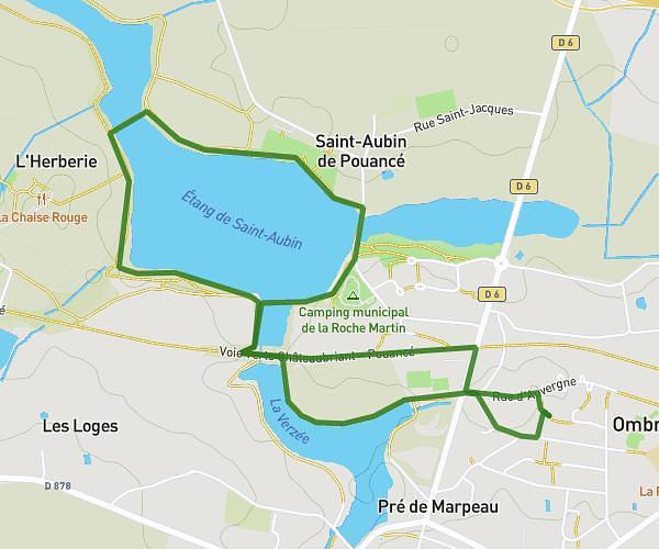
This hiking trail covers 5.884mi starting from Segré-en-Anjou Bleu, Maine-et-Loire. The hike does not return to the trailhead and ends near 1518 Route De La Gatelière, 49500 Segré-en-Anjou Bleu, France. This hike is rated as easy, plan for about 1h53m to complete it. The route has an elevation gain of 423ft and an elevation loss of 364ft.
Compostelle Segré 1
Route details
3.11mph
Speed
813 kcal
Calories burned
2.5%
Avg grade
Point to point
Route type
75ft
Min altitude
308ft
Max altitude
Route profile
423ft
Elevation gain
364ft
Elevation loss
75ft
Min altitude
308ft
Max altitude
How to get there
Trailhead: 32 Rue Des Quatre Vents, 49500 Segré-en-Anjou Bleu, France
GPS coordinates of the trailhead: 47.69262, -0.87741 / 47°41'33'' N, 0°52'38'' W