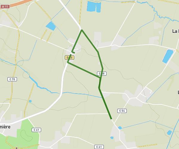
This hiking trail covers 3.057mi starting from Mésanger, Loire-Atlantique. The hike does not return to the trailhead and ends near 750 Boulevard De La Prairie, 44150 Ancenis-Saint-Géréon, France. This hike is rated as easy, plan for about 59m1s to complete it. The route has an elevation gain of 105ft and an elevation loss of 105ft.
Millaudière-Espace 23
Route details
3.11mph
Speed
418 kcal
Calories burned
1.3%
Avg grade
Point to point
Route type
49ft
Min altitude
95ft
Max altitude
Route profile
105ft
Elevation gain
105ft
Elevation loss
49ft
Min altitude
95ft
Max altitude
How to get there
Trailhead: 5 L’Océane, 44522 Mésanger, France
GPS coordinates of the trailhead: 47.39885, -1.20962 / 47°23'55'' N, 1°12'34'' W