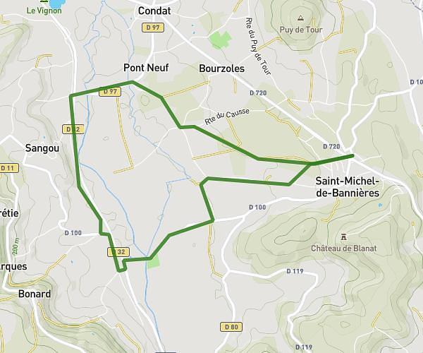
This walking route covers 4.868mi starting from Puybrun, Lot. The walk is a loop trail and returns to the trailhead. This walk is rated as moderate, plan for about 1h44m to complete it. The route has an elevation gain of 240ft and an elevation loss of 240ft.
Puybrun plaine
Route details
21:22/mi
Pace
425 kcal
Calories burned
Loop trail
Route type
400ft
Min altitude
456ft
Max altitude
Route profile
240ft
Elevation gain
240ft
Elevation loss
400ft
Min altitude
456ft
Max altitude
How to get there
Trailhead: Route De La Dordogne, 46130 Puybrun, France
GPS coordinates of the trailhead: 44.919994, 1.799789 / 44°55'11'' N, 1°47'59'' E