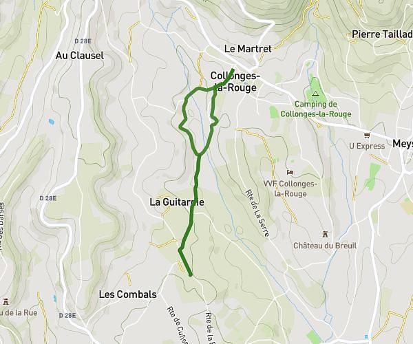
This walking route covers 4.769mi starting from Meyronne, Lot. The walk is a loop trail and returns to the trailhead. This walk is rated as moderate, plan for about 1h42m to complete it. The route has an elevation gain of 1083ft and an elevation loss of 1083ft.
Sainte Marie Meyronne
Route details
21:25/mi
Pace
417 kcal
Calories burned
Loop trail
Route type
344ft
Min altitude
810ft
Max altitude
Route profile
1083ft
Elevation gain
1083ft
Elevation loss
344ft
Min altitude
810ft
Max altitude
How to get there
Trailhead: 862 Route Du Limon, 46200 Meyronne, France
GPS coordinates of the trailhead: 44.863531, 1.591859 / 44°51'48'' N, 1°35'30'' E