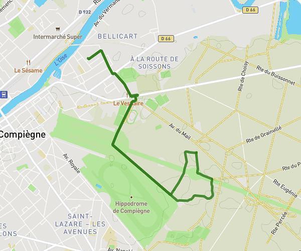
This running route covers 2.783mi starting from Janville, Oise. The run is a loop trail and returns to the trailhead. This run is rated as easy, expect about 26m to complete it. The route has an elevation gain of 115ft and an elevation loss of 115ft.
tour de l'ile Janville
Route details
6.42mph
Speed
297 kcal
Calories burned
Loop trail
Route type
105ft
Min altitude
144ft
Max altitude
Route profile
115ft
Elevation gain
115ft
Elevation loss
105ft
Min altitude
144ft
Max altitude
How to get there
Trailhead: 109 Rue René Richard, 60150 Janville, France
GPS coordinates of the trailhead: 49.44973, 2.86482 / 49°26'59'' N, 2°51'53'' E