MapPlanner
13.535mi
Distance
2h23m
Duration
10:34/mi
Pace
Strenuous
Level

Bienmongaté

Route details

5.68mph
Speed
1635 kcal
Calories burned
Loop trail
Route type
909ft
Min altitude
1227ft
Max altitude

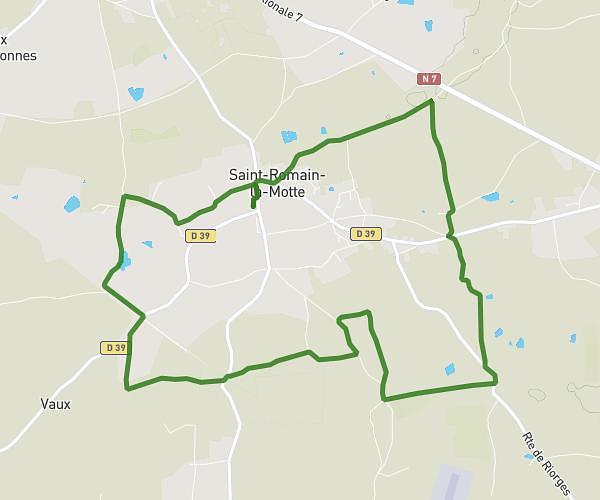
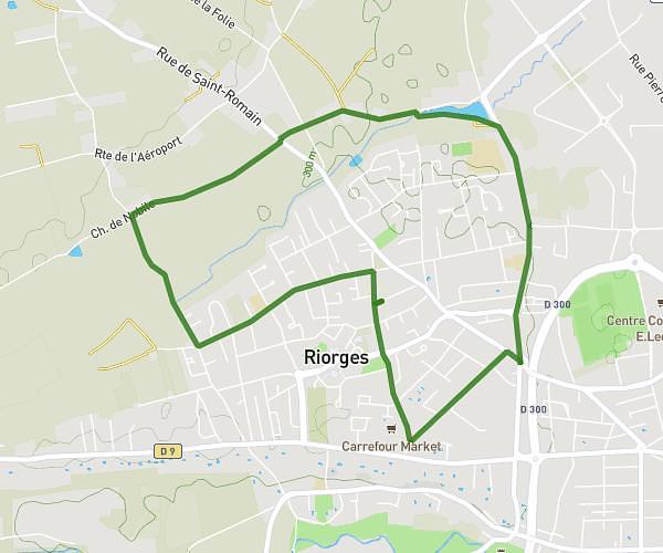
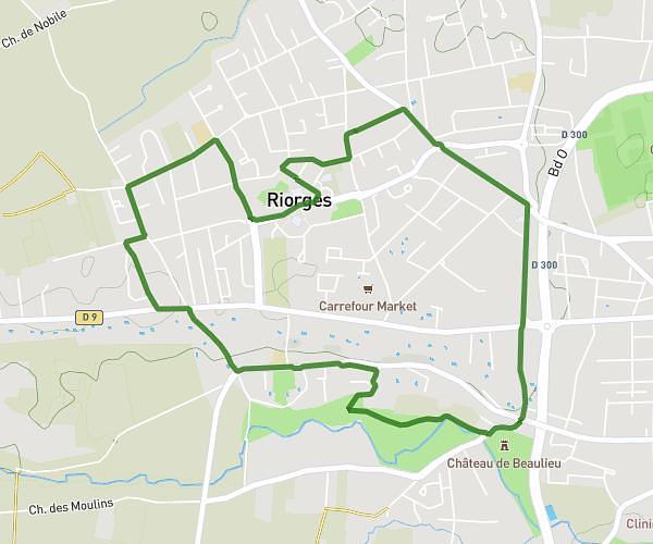
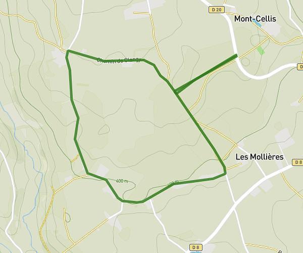
This running route covers 13.535mi starting from Noailly, Loire. The run is a loop trail and returns to the trailhead. This run is rated as strenuous, expect about 2h23m to complete it. The route has an elevation gain of 988ft and an elevation loss of 988ft.

Route profile

988ft
Elevation gain
988ft
Elevation loss
909ft
Min altitude
1227ft
Max altitude

How to get there

Trailhead: Rue Du Sacre, 42640 Noailly

GPS coordinates of the trailhead: 46.13049, 4.01627 / 46°7'49'' N, 4°0'58'' E

Caution: May Cross Private Property

This route may pass through or near private property. Always respect posted signs, obtain permission where required, and follow local trespassing laws. MapPlanner does not guarantee public access along any route.

Safety Notice

Trail and road conditions may change without notice due to weather, construction, or other factors. Always verify current conditions before heading out. You are responsible for your own safety — follow local signage, obey traffic laws, and use your best judgment on the trail.