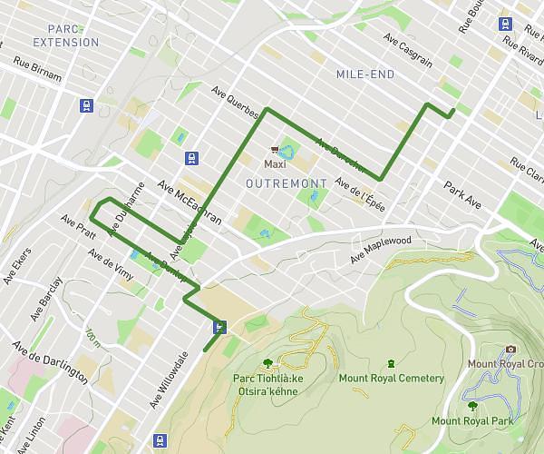
This running route covers 1.607mi starting from Montréal, Quebec. The run is a loop trail and returns to the trailhead. This run is rated as easy, expect about 17m14s to complete it. The route has an elevation gain of 79ft and an elevation loss of 82ft.
Canal Et Parc Vinet
Route details
5.6mph
Speed
197 kcal
Calories burned
Loop trail
Route type
49ft
Min altitude
75ft
Max altitude
Route profile
79ft
Elevation gain
82ft
Elevation loss
49ft
Min altitude
75ft
Max altitude
How to get there
Trailhead: 271 Avenue Greene, Montréal, Quebec H4C 2H9, Canada
GPS coordinates of the trailhead: 45.480537, -73.578479 / 45°28'49'' N, 73°34'42'' W