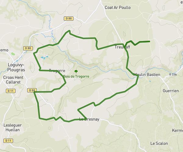
This cycling route covers 11.632mi starting from Plounévez-Moëdec, Côtes-d'Armor. The ride does not return to the trailhead and ends near Chemin Du Milin Bastien, 22810 Plounévez-Moëdec, France. This route is rated as easy, plan for about 1h10m to complete it. The route has an elevation gain of 190ft and an elevation loss of 266ft.
rando ste jeune 20km
Route details
615 kcal
Calories burned
0.7%
Avg grade
Point to point
Route type
509ft
Min altitude
591ft
Max altitude
Route profile
190ft
Elevation gain
266ft
Elevation loss
509ft
Min altitude
591ft
Max altitude
How to get there
Trailhead: 7 Penn An Nec’H, 22810 Plounévez-Moëdec, France
GPS coordinates of the trailhead: 48.52955, -3.4168 / 48°31'46'' N, 3°25'0'' W