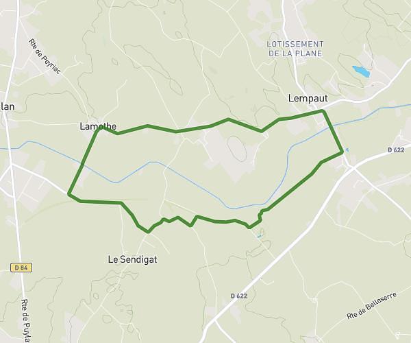
This running route covers 4.202mi starting from Revel, Haute-Garonne. The run is a loop trail and returns to the trailhead. This run is rated as easy, expect about 50m1s to complete it. The route has an elevation gain of 43ft and an elevation loss of 43ft.
Revel 6,7
Route details
5.04mph
Speed
572 kcal
Calories burned
Loop trail
Route type
705ft
Min altitude
748ft
Max altitude
Route profile
43ft
Elevation gain
43ft
Elevation loss
705ft
Min altitude
748ft
Max altitude
How to get there
Trailhead: 10 Avenue Julien Nouguier, 31250 Revel, France
GPS coordinates of the trailhead: 43.451925, 2.014624 / 43°27'6'' N, 2°0'52'' E