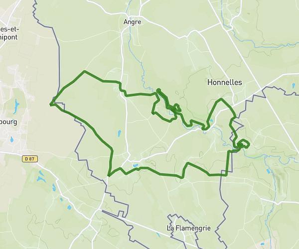
This hiking trail covers 6.218mi starting from Frameries, Hainaut. The hike is a loop trail and returns to the trailhead. This hike is rated as easy, plan for about 1h30m to complete it. The route has an elevation gain of 292ft and an elevation loss of 292ft.
Sars La Bruyère
Route details
4.14mph
Speed
639 kcal
Calories burned
1.8%
Avg grade
Loop trail
Route type
430ft
Min altitude
495ft
Max altitude
Route profile
292ft
Elevation gain
292ft
Elevation loss
430ft
Min altitude
495ft
Max altitude
How to get there
Trailhead: Place De Sars-La-Bruyère 2, 7080 Frameries, Hainaut, Belgium
GPS coordinates of the trailhead: 50.3708, 3.87751 / 50°22'14'' N, 3°52'39'' E