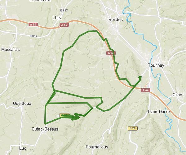
This walking route covers 6.972mi starting from Louit, Hautes-Pyrénées. The walk is a loop trail and returns to the trailhead. This walk is rated as hard, plan for about 2h30m to complete it. The route has an elevation gain of 548ft and an elevation loss of 545ft.
Dimanche 28/12/25
Route details
21:30/mi
Pace
613 kcal
Calories burned
Loop trail
Route type
804ft
Min altitude
1112ft
Max altitude
Route profile
548ft
Elevation gain
545ft
Elevation loss
804ft
Min altitude
1112ft
Max altitude
How to get there
Trailhead: 33 Rue Des Palombières, 65350 Louit, France
GPS coordinates of the trailhead: 43.305456, 0.159418 / 43°18'19'' N, 0°9'33'' E