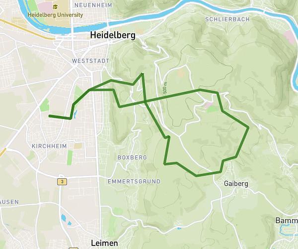
This running route covers 3.254mi starting from Mannheim, Baden-Württemberg. The run is a loop trail and returns to the trailhead. This run is rated as easy, expect about 35m to complete it. The route has an elevation gain of 157ft and an elevation loss of 161ft.
5 km
Route details
5.58mph
Speed
400 kcal
Calories burned
Loop trail
Route type
308ft
Min altitude
348ft
Max altitude
Route profile
157ft
Elevation gain
161ft
Elevation loss
308ft
Min altitude
348ft
Max altitude
How to get there
Trailhead: Kloppenheimer Straße 113, 68239 Mannheim, Germany
GPS coordinates of the trailhead: 49.462914, 8.556145 / 49°27'46'' N, 8°33'22'' E