MapPlanner
3.223mi
Distance
44m27s
Duration
13:48/mi
Pace
Easy
Level

Petit 5k

Route details

4.35mph
Speed
508 kcal
Calories burned
Loop trail
Route type
305ft
Min altitude
341ft
Max altitude

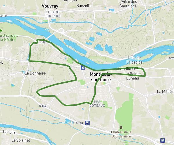
This running route covers 3.223mi starting from Tours, Indre-et-Loire. The run is a loop trail and returns to the trailhead. This run is rated as easy, expect about 44m27s to complete it. The route has an elevation gain of 75ft and an elevation loss of 79ft.

Route profile

75ft
Elevation gain
79ft
Elevation loss
305ft
Min altitude
341ft
Max altitude

How to get there

Trailhead: Rue Du Pavillon, 37100 Tours

GPS coordinates of the trailhead: 47.41489, 0.68822 / 47°24'53'' N, 0°41'17'' E

Caution: May Cross Private Property

This route may pass through or near private property. Always respect posted signs, obtain permission where required, and follow local trespassing laws. MapPlanner does not guarantee public access along any route.

Safety Notice

Trail and road conditions may change without notice due to weather, construction, or other factors. Always verify current conditions before heading out. You are responsible for your own safety — follow local signage, obey traffic laws, and use your best judgment on the trail.