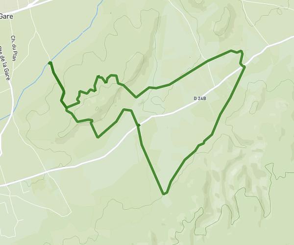
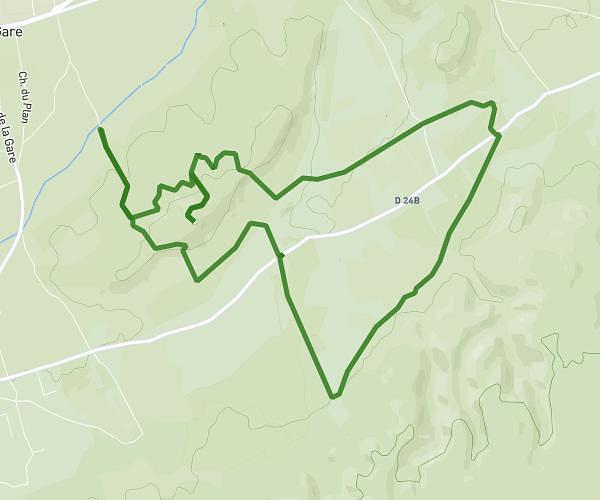
This running route covers 6.342mi starting from Le Thor, Vaucluse. The run is a loop trail and returns to the trailhead. This run is rated as moderate, expect about 1h8m to complete it. The route has an elevation gain of 295ft and an elevation loss of 295ft.
10km au thor
Route details
5.6mph
Speed
777 kcal
Calories burned
Loop trail
Route type
138ft
Min altitude
203ft
Max altitude
Route profile
295ft
Elevation gain
295ft
Elevation loss
138ft
Min altitude
203ft
Max altitude
How to get there
Trailhead: 85 Chemin De Monclar, 84250 Le Thor, France
GPS coordinates of the trailhead: 43.933878, 4.997893 / 43°56'1'' N, 4°59'52'' E