Explore this hiking route of 6.22km starting from Plateau d'Hauteville, Ain. The hike does not return to the starting point and ends near Avenue Félix Mangini, 01110 Plateau d'Hauteville. This hike has no defined difficulty level, plan for about 2h4m to complete it. The route has a positive elevation gain of 294m and a negative elevation loss of 77m.
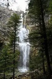
Cascades de la Melogne

Route details
Route profile
294m
Elevation +
77m
Elevation -
737m
Min altitude
954m
Max altitude
How to get there
Route starting point: D 21, 01110 Plateau d'Hauteville
GPS coordinates of the starting point: 45.96769, 5.5768 / 45°58'3'' N, 5°34'36'' E
Calculate the time to reach the starting point from your location or an address