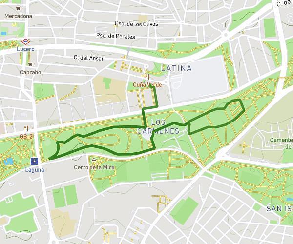
This running route covers 3.046mi starting from Madrid, Madrid. The run does not return to the trailhead and ends near Paseo De La Florida 39, 28008 Madrid, Madrid, Spain. This run is rated as easy, expect about 32m40s to complete it. The route has an elevation gain of 325ft and an elevation loss of 289ft.
hrs x macas
Route details
5.59mph
Speed
373 kcal
Calories burned
Point to point
Route type
1909ft
Min altitude
2011ft
Max altitude
Route profile
325ft
Elevation gain
289ft
Elevation loss
1909ft
Min altitude
2011ft
Max altitude
How to get there
Trailhead: Puente Del Rey, 28011 Madrid, Madrid, Spain
GPS coordinates of the trailhead: 40.418827, -3.721692 / 40°25'7'' N, 3°43'18'' W