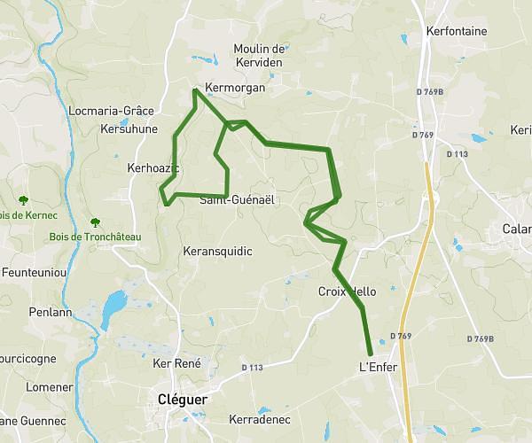
This hiking trail covers 9.395mi starting from Cléguer, Morbihan. The hike is a loop trail and returns to the trailhead. This hike is rated as moderate, plan for about 3h28m to complete it. The route has an elevation gain of 892ft and an elevation loss of 892ft.
15 km Pradic Gare de Meslien Arrière St Guénaël ancienne voie de chemin
Route details
2.71mph
Speed
1500 kcal
Calories burned
3.6%
Avg grade
Loop trail
Route type
85ft
Min altitude
364ft
Max altitude
Route profile
892ft
Elevation gain
892ft
Elevation loss
85ft
Min altitude
364ft
Max altitude
How to get there
Trailhead: 21 Rue De Cosquer, 56620 Cléguer, France
GPS coordinates of the trailhead: 47.860342, -3.348939 / 47°51'37'' N, 3°20'56'' W