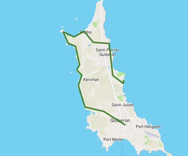
This hiking trail covers 9.076mi starting from Groix, Morbihan. The hike is a loop trail and returns to the trailhead. This hike is rated as moderate, plan for about 6h6m to complete it. The route has an elevation gain of 899ft and an elevation loss of 899ft.
Groix côtés saint nicolas
Route details
1.49mph
Speed
2646 kcal
Calories burned
3.8%
Avg grade
Loop trail
Route type
7ft
Min altitude
157ft
Max altitude
Route profile
899ft
Elevation gain
899ft
Elevation loss
7ft
Min altitude
157ft
Max altitude
How to get there
Trailhead: 2 Quai Port Tudy, 56590 Groix, France
GPS coordinates of the trailhead: 47.644055, -3.44889 / 47°38'38'' N, 3°26'56'' W