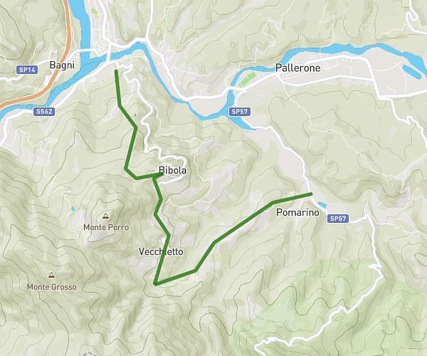
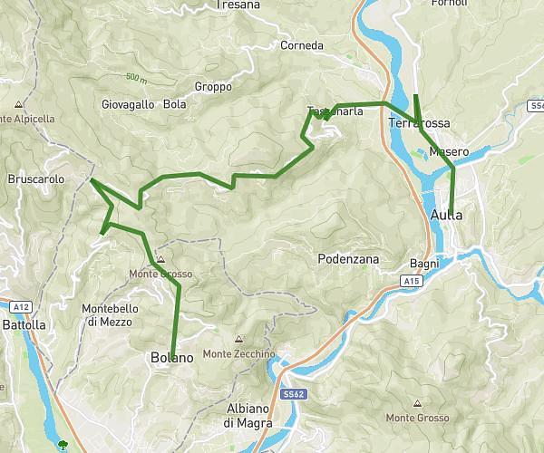
This running route covers 9.91mi starting from Aulla, Massa-Carrara. The run does not return to the trailhead and ends near Via Maestro Ferrari 8, 54011 Aulla Massa-Carrara, Italy. This run is rated as hard, expect about 2h35m to complete it. The route has an elevation gain of 1158ft and an elevation loss of 1125ft.
Aulla -Albiano via Podenzana
Route details
3.83mph
Speed
1772 kcal
Calories burned
Point to point
Route type
30ft
Min altitude
1188ft
Max altitude
Route profile
1158ft
Elevation gain
1125ft
Elevation loss
30ft
Min altitude
1188ft
Max altitude
How to get there
Trailhead: Viale Lunigiana 4, 54011 Aulla Massa-Carrara, Italy
GPS coordinates of the trailhead: 44.2124, 9.96667 / 44°12'44'' N, 9°58'0'' E