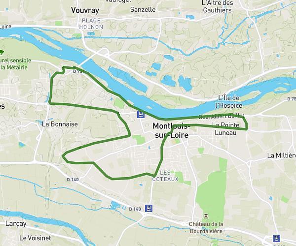
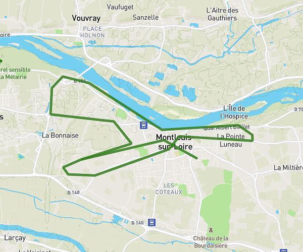
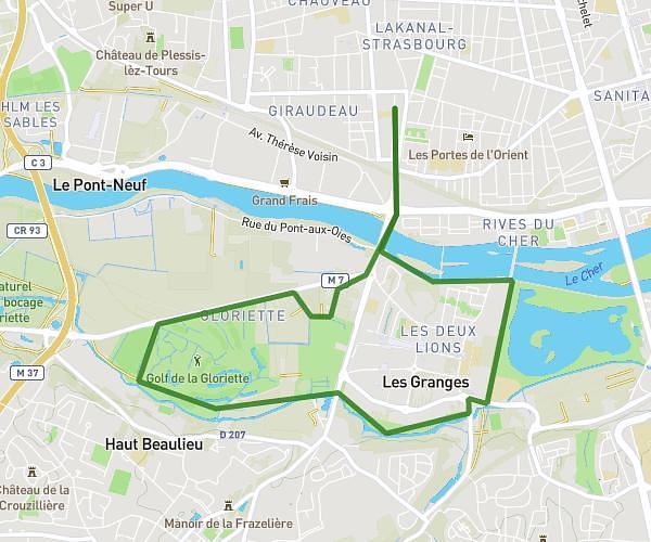
This running route covers 9.99mi starting from Tours, Indre-et-Loire. The run is a loop trail and returns to the trailhead. This run is rated as hard, expect about 2h to complete it. The route has an elevation gain of 417ft and an elevation loss of 413ft.
Anniv 25 ans 16 km
Route details
5.0mph
Speed
1372 kcal
Calories burned
Loop trail
Route type
154ft
Min altitude
341ft
Max altitude
Route profile
417ft
Elevation gain
413ft
Elevation loss
154ft
Min altitude
341ft
Max altitude
How to get there
Trailhead: 17 Avenue Marc Chagall, 37100 Tours, France
GPS coordinates of the trailhead: 47.414642, 0.681374 / 47°24'52'' N, 0°40'52'' E