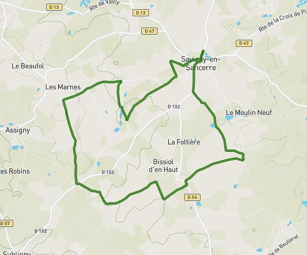
This hiking trail covers 4.714mi starting from Saint-Satur, Cher. The hike is a loop trail and returns to the trailhead. This hike is rated as easy, plan for about 51m to complete it. The route has an elevation gain of 433ft and an elevation loss of 430ft.
3 viaducs
Route details
5.55mph
Speed
367 kcal
Calories burned
3.5%
Avg grade
Loop trail
Route type
472ft
Min altitude
617ft
Max altitude
Route profile
433ft
Elevation gain
430ft
Elevation loss
472ft
Min altitude
617ft
Max altitude
How to get there
Trailhead: 6a Rue Du Commerce, 18300 Saint-Satur, France
GPS coordinates of the trailhead: 47.339281, 2.856585 / 47°20'21'' N, 2°51'23'' E