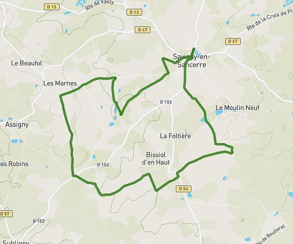
This hiking trail covers 5.627mi starting from Sancerre, Cher. The hike is a loop trail and returns to the trailhead. This hike is rated as moderate, plan for about 2h12m to complete it. The route has an elevation gain of 778ft and an elevation loss of 781ft.
JAYKO AMIGNY
Route details
2.56mph
Speed
964 kcal
Calories burned
5.2%
Avg grade
Loop trail
Route type
594ft
Min altitude
1083ft
Max altitude
Route profile
778ft
Elevation gain
781ft
Elevation loss
594ft
Min altitude
1083ft
Max altitude
How to get there
Trailhead: 7 Rue Des Chasseignes, 18300 Sancerre, France
GPS coordinates of the trailhead: 47.32682, 2.80424 / 47°19'36'' N, 2°48'15'' E