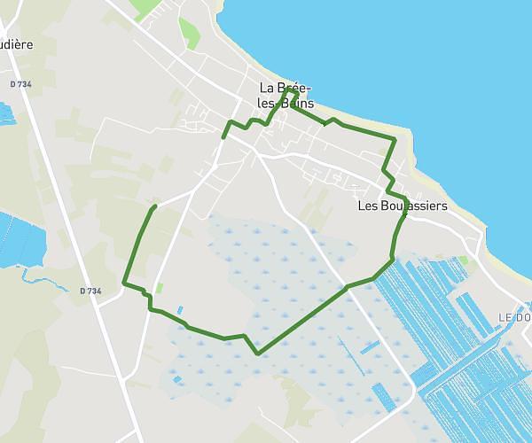
This hiking trail covers 4.05mi starting from Bourcefranc-le-Chapus, Charente-Maritime. The hike is a loop trail and returns to the trailhead. This hike is rated as easy, plan for about 56m36s to complete it. The route has an elevation gain of 79ft and an elevation loss of 82ft.
BOURCEFRANC
Route details
2.15mph
Speed
399 kcal
Calories burned
0.8%
Avg grade
Loop trail
Route type
0ft
Min altitude
30ft
Max altitude
Route profile
79ft
Elevation gain
82ft
Elevation loss
0ft
Min altitude
30ft
Max altitude
How to get there
Trailhead: 28 Avenue De La République, 17560 Bourcefranc-le-Chapus, France
GPS coordinates of the trailhead: 45.84345, -1.14313 / 45°50'36'' N, 1°8'35'' W