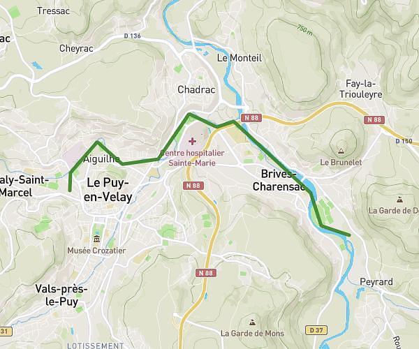
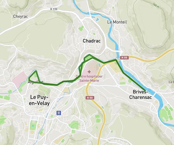
This running route covers 5.421mi starting from Le Puy-en-Velay, Haute-Loire. The run does not return to the trailhead and ends near 12 Impasse Du Viaduc, 43700 Saint-Germain-Laprade, France. This run is rated as moderate, expect about 58m to complete it. The route has an elevation gain of 226ft and an elevation loss of 285ft.
Voie verte Borne-Loire Massot-vers Peyrard
Route details
5.61mph
Speed
663 kcal
Calories burned
Point to point
Route type
1955ft
Min altitude
2051ft
Max altitude
Route profile
226ft
Elevation gain
285ft
Elevation loss
1955ft
Min altitude
2051ft
Max altitude
How to get there
Trailhead: 11 Rue Duguesclin, 43000 Le Puy-en-Velay, France
GPS coordinates of the trailhead: 45.04587, 3.87748 / 45°2'45'' N, 3°52'38'' E