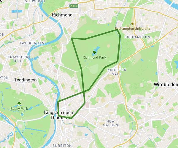
This cycling route covers 8.52mi starting from London, England. The ride is a loop trail and returns to the trailhead. This route is rated as moderate, plan for about 51m to complete it. The route has an elevation gain of 443ft and an elevation loss of 446ft.
Gunnersbury
Route details
452 kcal
Calories burned
2.0%
Avg grade
Loop trail
Route type
36ft
Min altitude
121ft
Max altitude
Route profile
443ft
Elevation gain
446ft
Elevation loss
36ft
Min altitude
121ft
Max altitude
How to get there
Trailhead: 16 Westfield Road, Ealing, London, W13 9JR, United Kingdom
GPS coordinates of the trailhead: 51.508868, -0.322984 / 51°30'31'' N, 0°19'22'' W