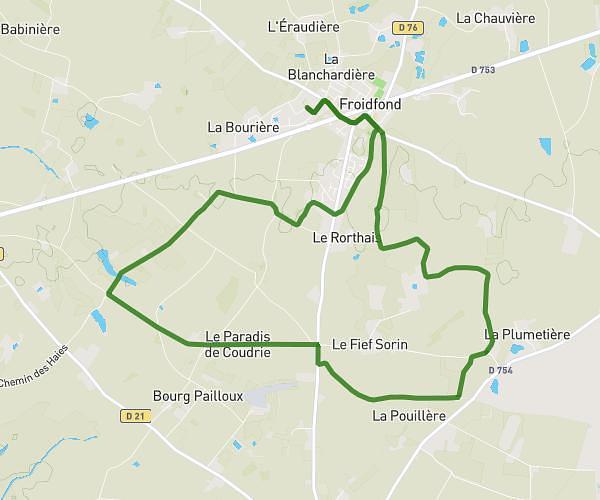
This hiking trail covers 10.241mi starting from Froidfond, Vendée. The hike is a loop trail and returns to the trailhead. This hike is rated as easy, plan for about 3h17m to complete it. The route has an elevation gain of 253ft and an elevation loss of 256ft.
Don sang froidfond 17km
Route details
3.11mph
Speed
1395 kcal
Calories burned
0.9%
Avg grade
Loop trail
Route type
92ft
Min altitude
190ft
Max altitude
Route profile
253ft
Elevation gain
256ft
Elevation loss
92ft
Min altitude
190ft
Max altitude
How to get there
Trailhead: Zone Artisanale Terres Neuves, 85300 Froidfond
GPS coordinates of the trailhead: 46.87004, -1.76489 / 46°52'12'' N, 1°45'53'' W