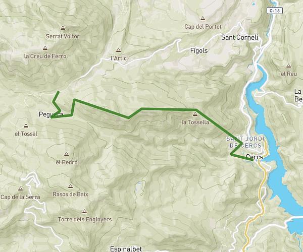
This hiking trail covers 8.893mi starting from Súria, Barcelona. The hike does not return to the trailhead and ends near Camí De Cardona A Serrateix, 08673 Viver i Serrateix. This hike is rated as moderate, plan for about 10m to complete it. The route has an elevation gain of 1385ft and an elevation loss of 141ft.
Riera D'Hortons
Route details
53.36mph
Speed
73 kcal
Calories burned
3.2%
Avg grade
Point to point
Route type
938ft
Min altitude
2182ft
Max altitude
Route profile
1385ft
Elevation gain
141ft
Elevation loss
938ft
Min altitude
2182ft
Max altitude
How to get there
Trailhead: Carrer D'àngel Guimerà, 08260 Súria
GPS coordinates of the trailhead: 41.83649, 1.74939 / 41°50'11'' N, 1°44'57'' E