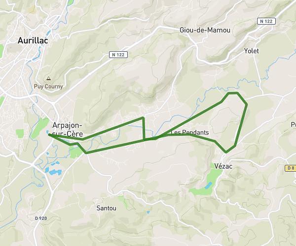
This running route covers 2.208mi starting from Vézac, Cantal. The run is a loop trail and returns to the trailhead. This run is rated as easy, expect about 24m to complete it. The route has an elevation gain of 335ft and an elevation loss of 335ft.
Tour du golf
Route details
5.52mph
Speed
274 kcal
Calories burned
Loop trail
Route type
2129ft
Min altitude
2257ft
Max altitude
Route profile
335ft
Elevation gain
335ft
Elevation loss
2129ft
Min altitude
2257ft
Max altitude
How to get there
Trailhead: 21 Rue Marcel Dauzier, 15130 Vézac, France
GPS coordinates of the trailhead: 44.890391, 2.517472 / 44°53'25'' N, 2°31'2'' E