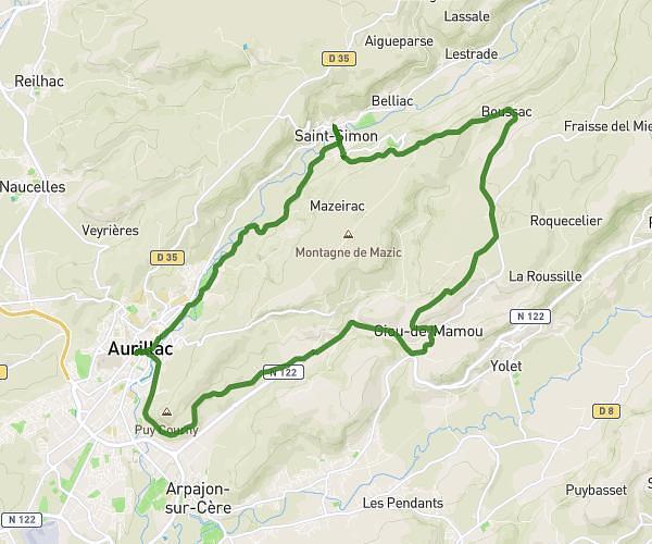
This running route covers 8.723mi starting from Aurillac, Cantal. The run is a loop trail and returns to the trailhead. This run is rated as hard, expect about 1h34m to complete it. The route has an elevation gain of 869ft and an elevation loss of 869ft.
Crête St Simon
Route details
5.57mph
Speed
1075 kcal
Calories burned
Loop trail
Route type
2047ft
Min altitude
2776ft
Max altitude
Route profile
869ft
Elevation gain
869ft
Elevation loss
2047ft
Min altitude
2776ft
Max altitude
How to get there
Trailhead: 7 Rue Du 14 Juillet, 15000 Aurillac, France
GPS coordinates of the trailhead: 44.927728, 2.442447 / 44°55'39'' N, 2°26'32'' E