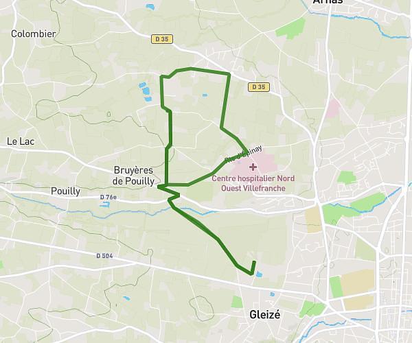
This hiking trail covers 4.303mi starting from Charentay, Rhône. The hike is a loop trail and returns to the trailhead. This hike is rated as easy, plan for about 42m to complete it. The route has an elevation gain of 420ft and an elevation loss of 420ft.
randonnée 15/10 4EA 2nd
Route details
6.15mph
Speed
303 kcal
Calories burned
3.7%
Avg grade
Loop trail
Route type
722ft
Min altitude
961ft
Max altitude
Route profile
420ft
Elevation gain
420ft
Elevation loss
722ft
Min altitude
961ft
Max altitude
How to get there
Trailhead: Rue De Sermezy, 69220 Charentay
GPS coordinates of the trailhead: 46.08116, 4.67929 / 46°4'52'' N, 4°40'45'' E