MapPlanner
5.572mi
Distance
34m
Duration
9.84mph
Speed
+135ft
Elevation gain
-138ft
Elevation loss
Easy
Level

Foret de Marchiennes

Route details

299 kcal
Calories burned
0.9%
Avg grade
Loop trail
Route type
72ft
Min altitude
105ft
Max altitude

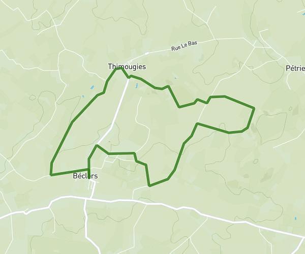
This cycling route covers 5.572mi starting from Beuvry-la-Forêt, Nord. The ride is a loop trail and returns to the trailhead. This route is rated as easy, plan for about 34m to complete it. The route has an elevation gain of 135ft and an elevation loss of 138ft.

Route profile

135ft
Elevation gain
138ft
Elevation loss
72ft
Min altitude
105ft
Max altitude

How to get there

Trailhead: Chemin Du Fiot Bouché, 59310 Beuvry-la-Forêt, France

GPS coordinates of the trailhead: 50.437, 3.29503 / 50°26'13'' N, 3°17'42'' E

Caution: May Cross Private Property

This route may pass through or near private property. Always respect posted signs, obtain permission where required, and follow local trespassing laws. MapPlanner does not guarantee public access along any route.

Safety Notice

Trail and road conditions may change without notice due to weather, construction, or other factors. Always verify current conditions before heading out. You are responsible for your own safety — follow local signage, obey traffic laws, and use your best judgment on the trail.