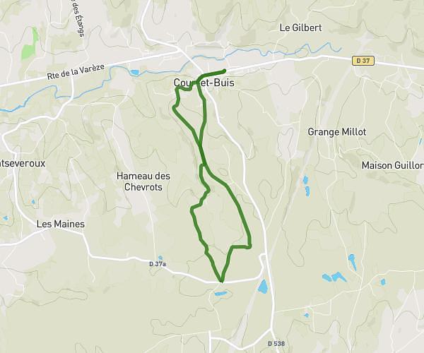
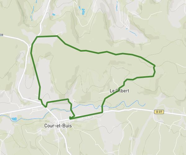
This running route covers 8.831mi starting from Saint-Jacques-d'Atticieux, Ardèche. The run does not return to the trailhead and ends near 30 Rue De Mirguillaume, 07340 Saint-Jacques-d'Atticieux, France. This run is rated as hard, expect about 1h35m to complete it. The route has an elevation gain of 666ft and an elevation loss of 433ft.
Entraînement avec yoyo
Route details
5.58mph
Speed
1086 kcal
Calories burned
Point to point
Route type
1457ft
Min altitude
2087ft
Max altitude
Route profile
666ft
Elevation gain
433ft
Elevation loss
1457ft
Min altitude
2087ft
Max altitude
How to get there
Trailhead: 40 Rue Des Vents, 07340 Saint-Jacques-d'Atticieux, France
GPS coordinates of the trailhead: 45.333901, 4.665715 / 45°20'2'' N, 4°39'56'' E