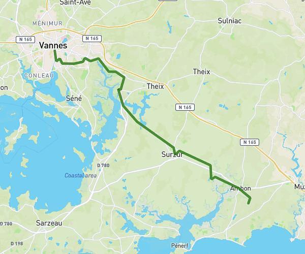
This hiking trail covers 5.653mi starting from Elven, Morbihan. The hike does not return to the trailhead and ends near Rue Du Verger, 56250 La Vraie-Croix. This hike is rated as moderate, plan for about 1h30m to complete it. The route has an elevation gain of 528ft and an elevation loss of 436ft.
Mlvc
Route details
3.77mph
Speed
649 kcal
Calories burned
3.2%
Avg grade
Point to point
Route type
220ft
Min altitude
430ft
Max altitude
Route profile
528ft
Elevation gain
436ft
Elevation loss
220ft
Min altitude
430ft
Max altitude
How to get there
Trailhead: C 1, 56250 Elven
GPS coordinates of the trailhead: 47.7297, -2.55293 / 47°43'46'' N, 2°33'10'' W