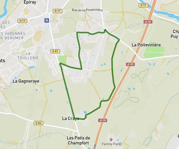
This running route covers 2.897mi starting from Saint-Cyr-sur-Loire, Indre-et-Loire. The run is a loop trail and returns to the trailhead. This run is rated as easy, expect about 31m5s to complete it. The route has an elevation gain of 131ft and an elevation loss of 131ft.
Boucle 5&10km Saint-Cyr
Route details
5.59mph
Speed
355 kcal
Calories burned
Loop trail
Route type
292ft
Min altitude
331ft
Max altitude
Route profile
131ft
Elevation gain
131ft
Elevation loss
292ft
Min altitude
331ft
Max altitude
How to get there
Trailhead: 6 Rond-Point René Coulon, 37540 Saint-Cyr-sur-Loire, France
GPS coordinates of the trailhead: 47.41913, 0.653605 / 47°25'8'' N, 0°39'12'' E