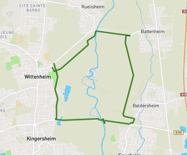
This running route covers 6.283mi starting from Riedisheim, Haut-Rhin. The run is a loop trail and returns to the trailhead. This run is rated as moderate, expect about 1h7m to complete it. The route has an elevation gain of 190ft and an elevation loss of 226ft.
Training urban trail mulhouse
Route details
5.62mph
Speed
766 kcal
Calories burned
Loop trail
Route type
866ft
Min altitude
1053ft
Max altitude
Route profile
190ft
Elevation gain
226ft
Elevation loss
866ft
Min altitude
1053ft
Max altitude
How to get there
Trailhead: 32 Rue De La Couronne, 68400 Riedisheim, France
GPS coordinates of the trailhead: 47.74108, 7.35553 / 47°44'27'' N, 7°21'19'' E