MapPlanner
Subscribe to Explorer
km
Kilometers
Miles
France (€)
Belgique (€)
United Kingdom (£)
Ireland (€)
United States ($)
Canada ($CA)
Italia (€)
Deutschland (€)
Österreich (€)
España (€)
Schweiz (CHF)
Australia (AU$)
Open user menu
Sign up
Log in
Open main menu
Calculate distance
Search for a route
MapPlanner
Close menu
Subscribe to Explorer
Draw your route
Search for a route
Create an Account
Close modal
Log In
Close modal
MapPlanner
2 km
Elevation
22.35km
Distance
5h34m
Duration
4.01km/h
Speed
260m
Elevation +
1728m
Elevation -
1402m
Minimum altitude
2870m
Maximum altitude
Mardi - Les Guibertes
Hiking
julwant@gmail.com
France
Hautes-Alpes
Villar-d'Arêne
Hikes
Route details
05480 Villar-d'Arêne / Rue De Labessia, 05220 Le Monêtier-les-Bains
Round-trip address
Export route as GPX
Discover nearby hiking trails
Hiking
trajets 6 cabanes
6,73
km
•
3
h
21
m
•
+964
m
Hautes-Alpes - Saint-Maurice-en-Valgodemard
Hiking
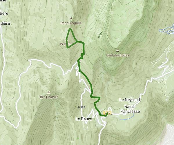
Pravouta AR 9km 800D+
9,19
km
•
5
h
•
+823
m
Isère - Plateau-des-Petites-Roches
Hiking
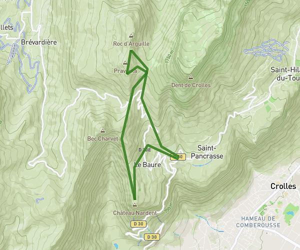
Pravouta + Château Nardent 12km Les Meunières
12,4
km
•
5
h
Isère - Plateau-des-Petites-Roches
Hiking
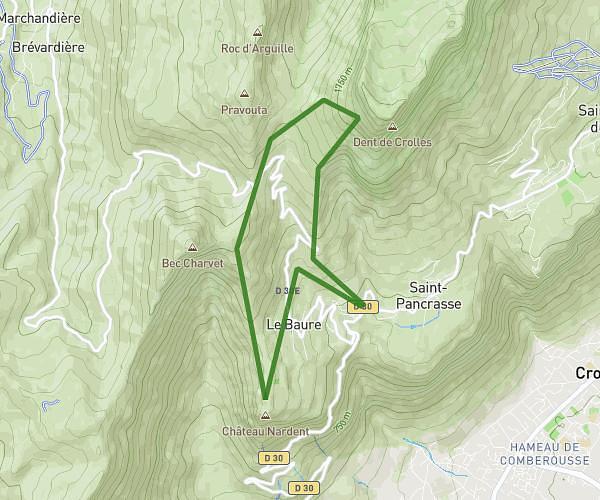
Randonnée Dent de Crolles - Les Meunières
12,25
km
•
2
h
4
m
•
+1139
m
Isère - Plateau-des-Petites-Roches
Success
Success
Success
Success
Close