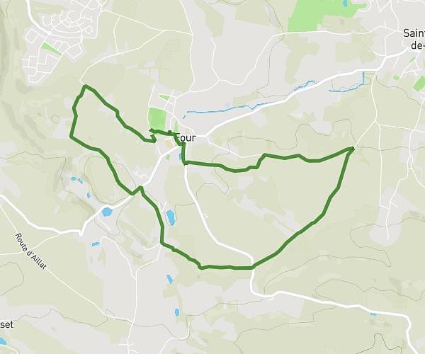
This hiking trail covers 7.707mi starting from Plateau-des-Petites-Roches, Isère. The hike is a loop trail and returns to the trailhead. This hike is rated as strenuous, plan for about 5h to complete it. The route has an elevation gain of 2894ft and an elevation loss of 2913ft.
Pravouta + Château Nardent 12km Les Meunières
Route details
1.54mph
Speed
2349 kcal
Calories burned
14.3%
Avg grade
Loop trail
Route type
3136ft
Min altitude
5728ft
Max altitude
Steep climb
Route profile
2894ft
Elevation gain
2913ft
Elevation loss
3136ft
Min altitude
5728ft
Max altitude
How to get there
Trailhead: Route Des 3 Villages, 38660 Plateau-des-Petites-Roches
GPS coordinates of the trailhead: 45.29102, 5.85169 / 45°17'27'' N, 5°51'6'' E