MapPlanner
5.4mi
Distance
3h34m
Duration
+2454ft
Elevation gain
-2589ft
Elevation loss
Hard
Level

Vercos : La Grande Sœur Agathe et la La Petite Sœur Sophie

To the first Sister Sophie
First Ibex between the 2 Sisters
Ibex not very shy
Ibex not very shy
Many chamois can be seen around the first Sister
Ibex and chamois under the first Sister
The first Sister Sophie
An ibex is watching us
View of Grenoble in the distance from Sœur Sophie
View of Big Sister Agathe
Lake Moucherolle
Lake Moucherolle

Route details

1.51mph
Speed
1719 kcal
Calories burned
17.7%
Avg grade
Point to point
Route type
5676ft
Min altitude
7188ft
Max altitude
Steep climb

This hiking trail covers 5.4mi starting from Villard-de-Lans, Isère. The hike does not return to the trailhead and ends near Daim, 38250 Villard-de-Lans, France. This hike is rated as hard, plan for about 3h34m to complete it. The route has an elevation gain of 2454ft and an elevation loss of 2589ft.

Description of the route by the creator

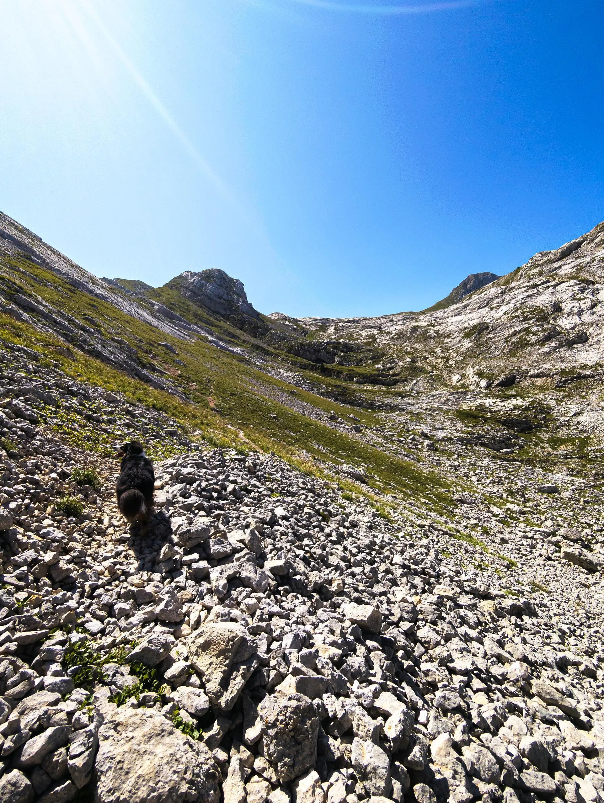
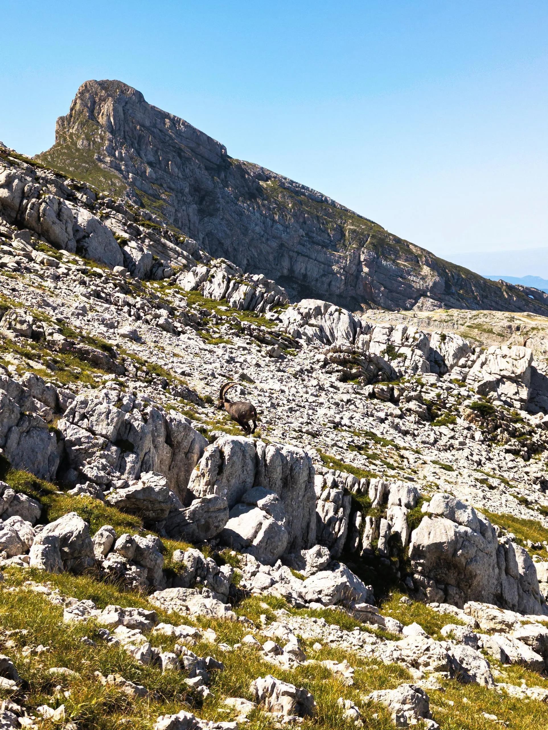
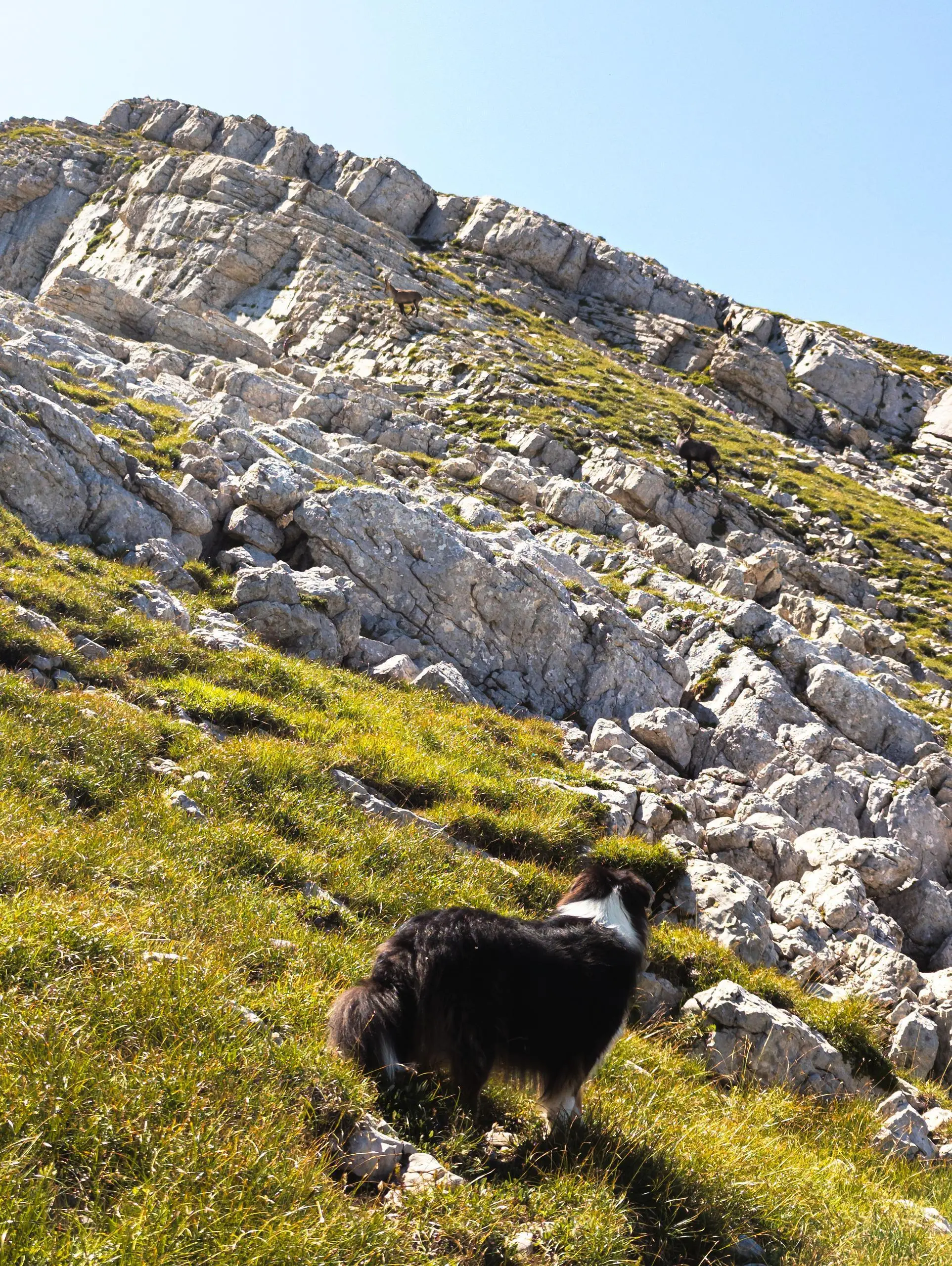
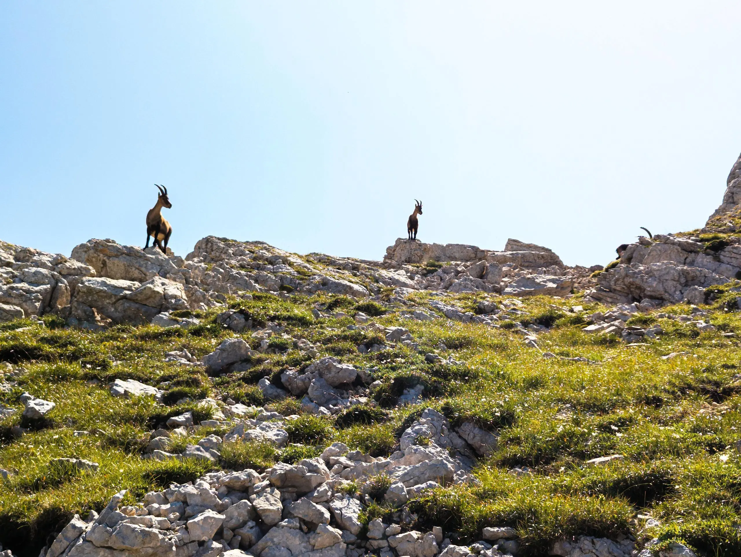
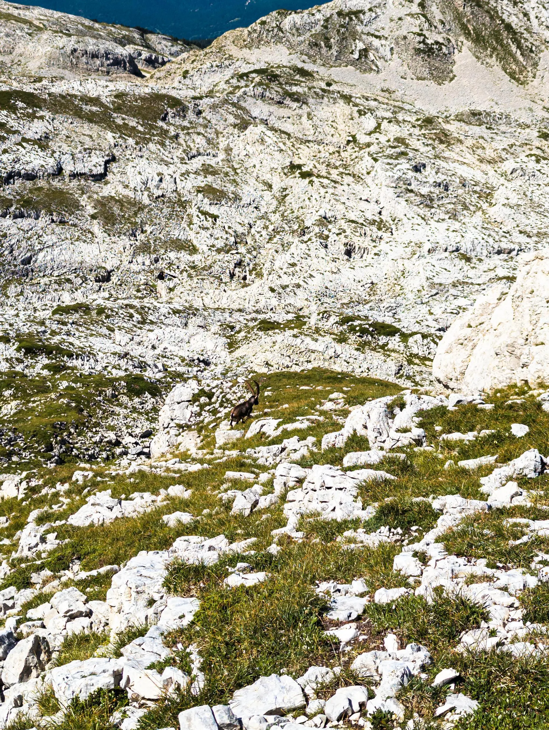
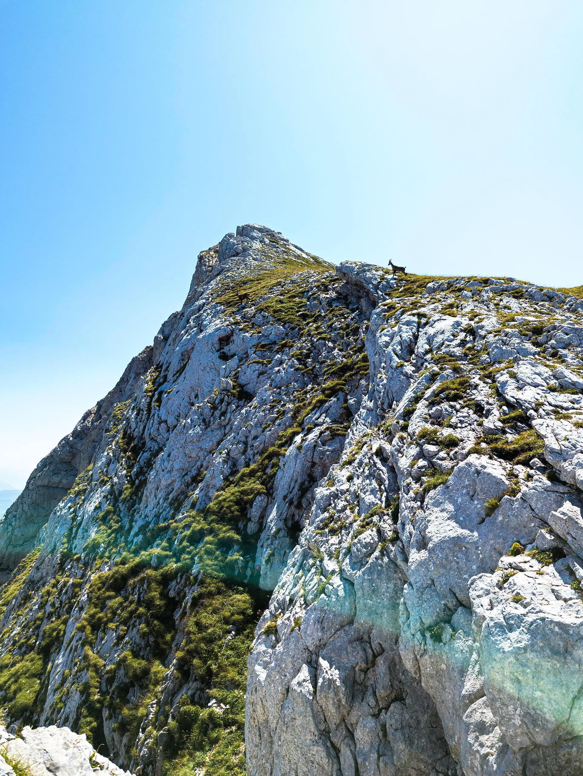
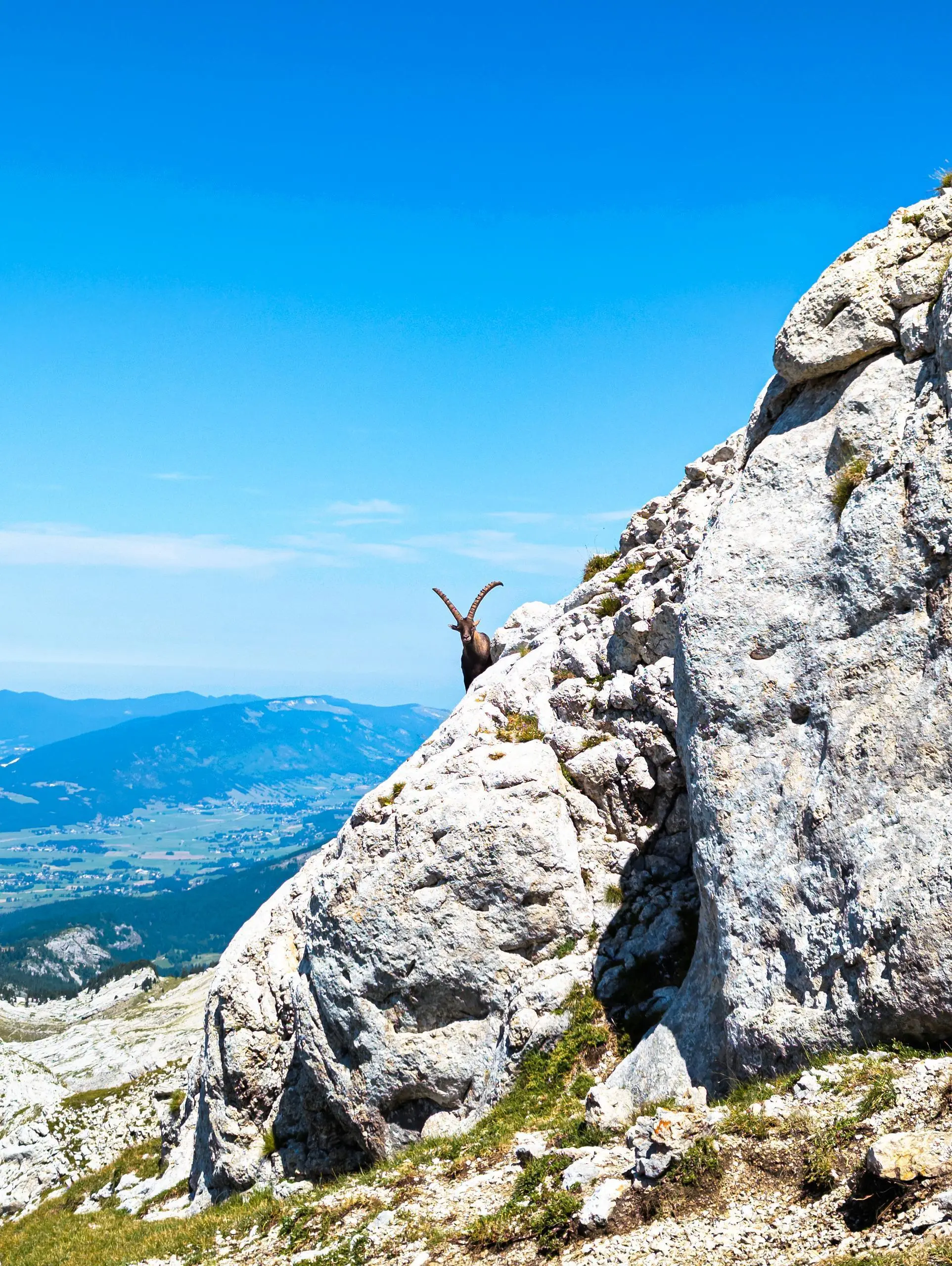
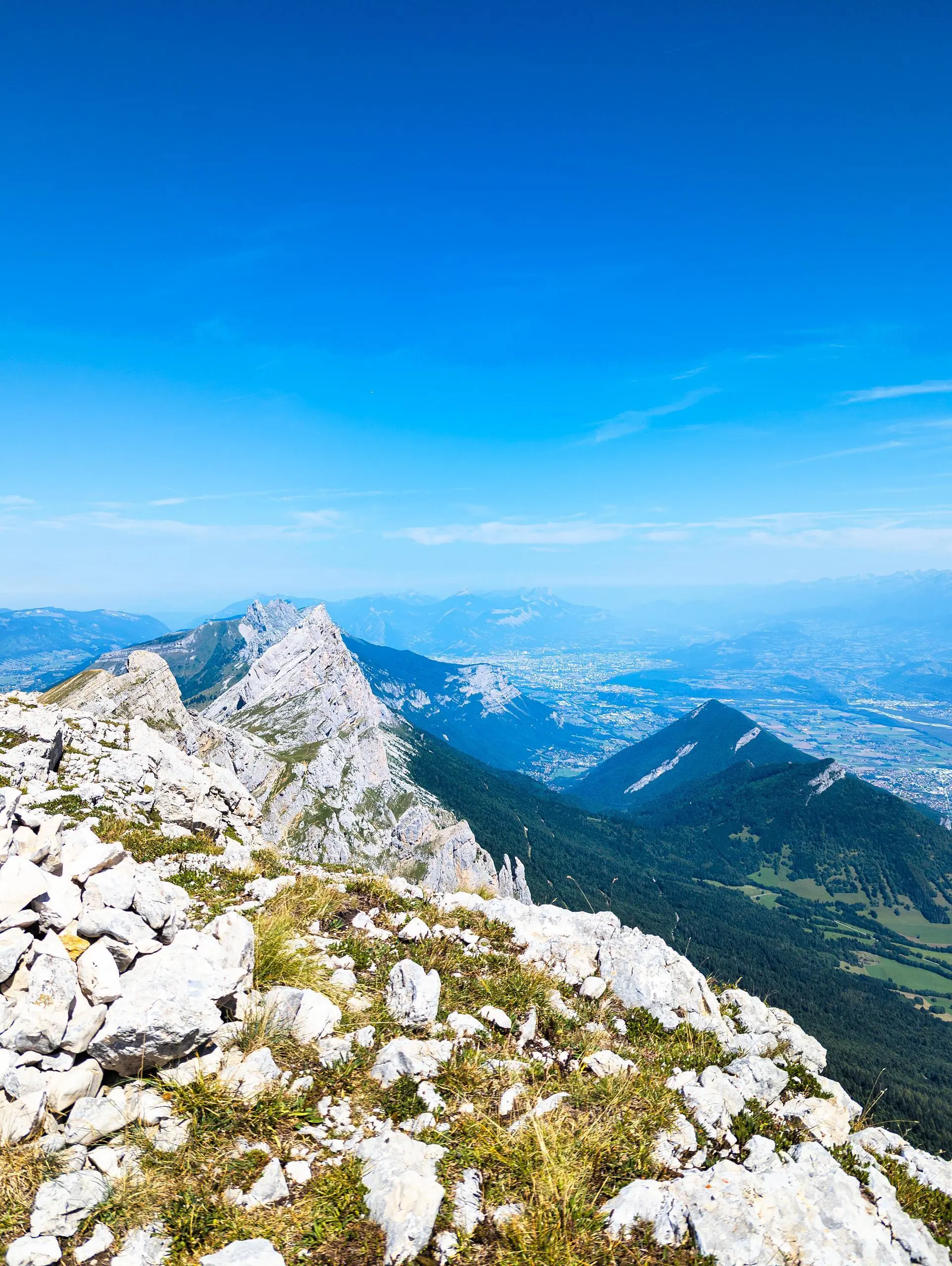
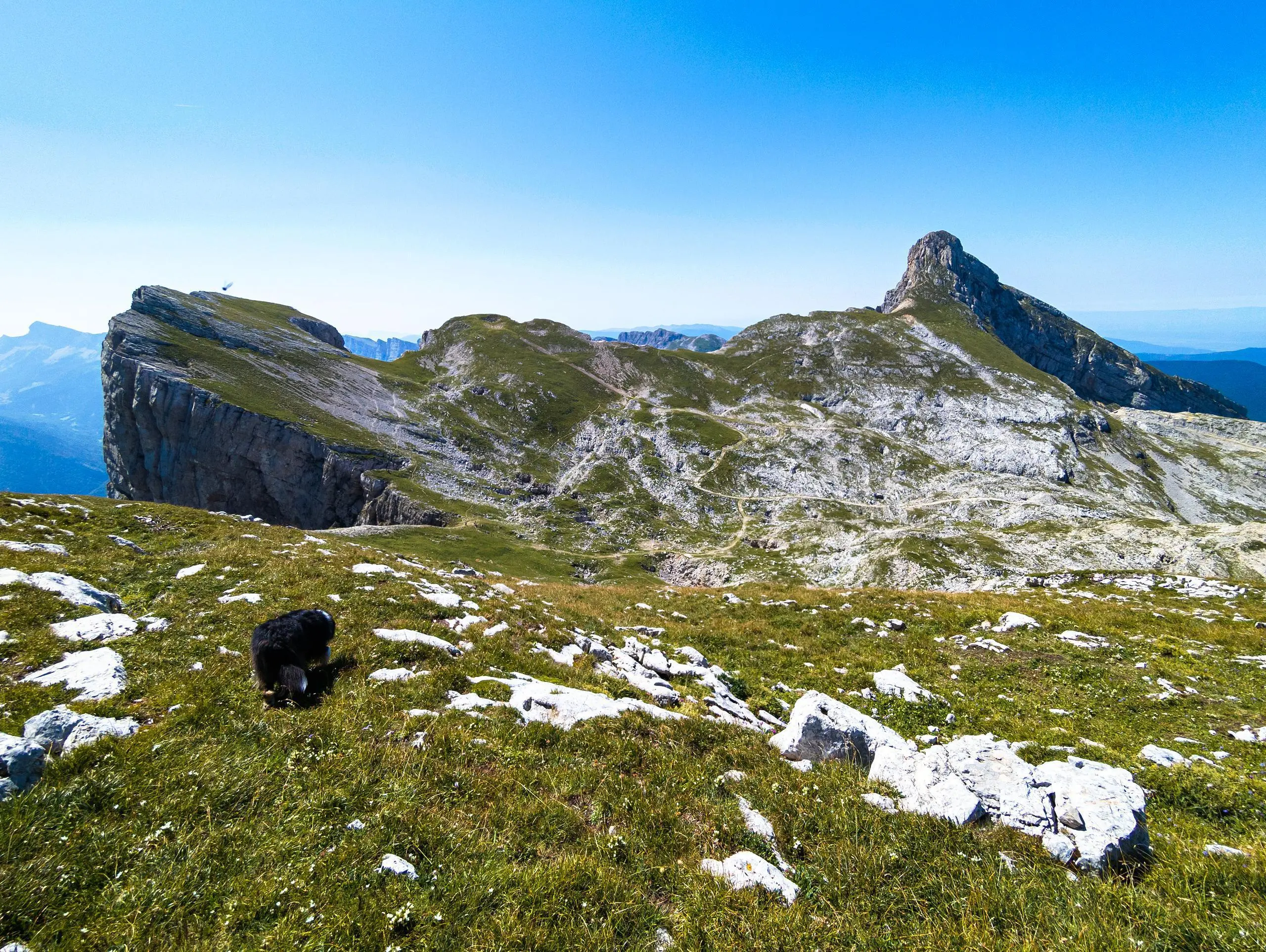
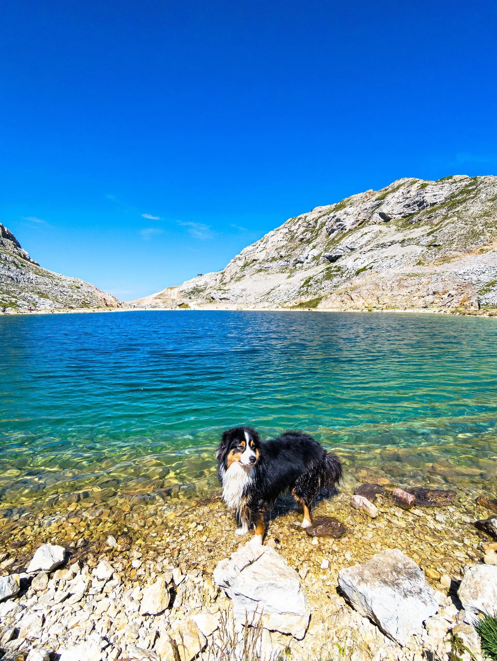
A typical hike in the nearby northern Vercors from Villard-de-Lans. To make the walk easier, park at Balcon de Villard and take the "Côte 2000" cable car from the parking lot. The first part of the trail is clearly visible, but unmarked. It follows the side of the mountain to reach the first "Sœur". Many chamois and ibex are present in this area, but they are not shy or afraid of dogs! Descend slightly to reach the Col des 2 Sœurs, then climb again to reach the summit of the walk: La Grande Sœur Agathe. Return to the resort via Lac de la Moucherolle, where the path is wide and easy to follow. Finally, take the cable car back to the resort parking lot (check the timetable first).

(Description automatically translated)

Route profile

2454ft
Elevation gain
2589ft
Elevation loss
5676ft
Min altitude
7188ft
Max altitude

How to get there

Trailhead: Daim, 38250 Villard-de-Lans, France

GPS coordinates of the trailhead: 45.02756, 5.57041 / 45°1'39'' N, 5°34'13'' E

Caution: May Cross Private Property

This route may pass through or near private property. Always respect posted signs, obtain permission where required, and follow local trespassing laws. MapPlanner does not guarantee public access along any route.

Safety Notice

Trail and road conditions may change without notice due to weather, construction, or other factors. Always verify current conditions before heading out. You are responsible for your own safety — follow local signage, obey traffic laws, and use your best judgment on the trail.