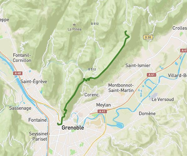
This hiking trail covers 7.611mi starting from Plateau-des-Petites-Roches, Isère. The hike is a loop trail and returns to the trailhead. This hike is rated as strenuous, plan for about 2h4m to complete it. The route has an elevation gain of 3737ft and an elevation loss of 3750ft.
Randonnée Dent de Crolles - Les Meunières
Route details
3.68mph
Speed
1003 kcal
Calories burned
18.6%
Avg grade
Loop trail
Route type
3140ft
Min altitude
6509ft
Max altitude
Steep climb
Route profile
3737ft
Elevation gain
3750ft
Elevation loss
3140ft
Min altitude
6509ft
Max altitude
How to get there
Trailhead: Route Des 3 Villages, 38660 Plateau-des-Petites-Roches
GPS coordinates of the trailhead: 45.29097, 5.85139 / 45°17'27'' N, 5°51'5'' E