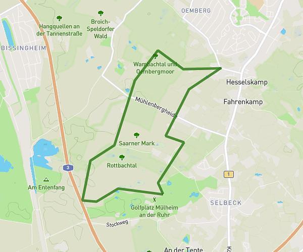
This running route covers 3.153mi starting from Mülheim, North Rhine-Westphalia. The run is a loop trail and returns to the trailhead. This run is rated as easy, expect about 34m to complete it. The route has an elevation gain of 200ft and an elevation loss of 200ft.
5km MH
Route details
5.56mph
Speed
389 kcal
Calories burned
Loop trail
Route type
164ft
Min altitude
266ft
Max altitude
Route profile
200ft
Elevation gain
200ft
Elevation loss
164ft
Min altitude
266ft
Max altitude
How to get there
Trailhead: Föhrenkamp 2a, 45481 Mülheim, Germany
GPS coordinates of the trailhead: 51.389151, 6.860984 / 51°23'20'' N, 6°51'39'' E