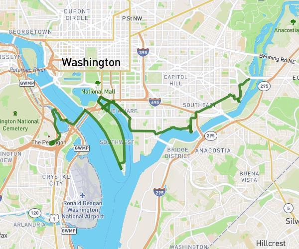
This cycling route covers 1.027mi starting from Washington, District of Columbia. The ride does not return to the trailhead and ends near 645 1st Street Northeast, Washington, District of Columbia 20002, United States. This route is rated as easy, plan for about 11m to complete it. The route has an elevation gain of 82ft and an elevation loss of 72ft.
Union Station
Route details
98 kcal
Calories burned
2.8%
Avg grade
Point to point
Route type
33ft
Min altitude
89ft
Max altitude
Route profile
82ft
Elevation gain
72ft
Elevation loss
33ft
Min altitude
89ft
Max altitude
How to get there
Trailhead: 35 Florida Avenue Northwest, Washington, District of Columbia 20001, United States
GPS coordinates of the trailhead: 38.911364, -77.010191 / 38°54'40'' N, 77°0'36'' W